Rosebud, South Dakota
|
Rosebud, South Dakota Sicanġu |
|
|---|---|
| CDP | |
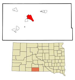
 Location in Todd County and the state of South Dakota |
|
| Coordinates: 43°14′28″N 100°51′7″W / 43.24111°N 100.85194°WCoordinates: 43°14′28″N 100°51′7″W / 43.24111°N 100.85194°W | |
| Country | United States |
| State | South Dakota |
| Counties | Todd |
| Area | |
| • Total | 13.1 sq mi (34 km2) |
| • Land | 13.1 sq mi (33.9 km2) |
| • Water | 0 sq mi (0.1 km2) |
| Population (2010) | |
| • Total | 1,587 |
| • Density | 121.1/sq mi (46.8/km2) |
Rosebud (Lakhota Sicanġu; "Scorched Thigh") is a census-designated place (CDP) in Todd County, South Dakota, United States. The population was 1,587 at the 2010 census.
Rosebud, located on the Rosebud Indian Reservation, is the home to the Rosebud Sioux Tribe Headquarters. Rosebud also has many tribal agencies such as the Indian Health Service, Bureau of Indian Affairs, Tribal Land Enterprise, Tribal BIA Police, and the Division of Forestry and Wildland Fire Management.
According to the United States Census Bureau, the CDP has a total area of 13.1 square miles (34 km2), of which, 13.1 square miles (34 km2) of it is land and 0.04 square miles (0.10 km2) of it (0.30%) is water.
Rosebud has been assigned the ZIP code 57570.
As of the census of 2000, there were 1,557 people, 405 households, and 315 families residing in the CDP. The population density was 119.1 people per square mile (46.0/km²). There were 465 housing units at an average density of 35.6 per square mile (13.7/km²). The racial makeup of the CDP was 4.17% White, 0.06% African American, 93.38% Native American, 0.39% Asian, 0.71% from other races, and 1.28% from two or more races. Hispanic or Latino of any race were 2.25% of the population.
...
Wikipedia
