Roman fortress in Moravia (Mušov)

Fortress praetorium
|
|
| Location | Moravia, Czech Republic |
|---|---|
| Region | Marcomania |
| Coordinates | 48°54′N 16°34′E / 48.900°N 16.567°ECoordinates: 48°54′N 16°34′E / 48.900°N 16.567°E |
| Type | Castrum |
| History | |
| Material | wood, stone, bricks |
| Periods | Roman Empire |
The Roman fort (Czech: římská pevnost), also known as German: Burgstall and Czech: Hradisko, is an archaeological site located in Mušov, Czech Republic, of a Roman army camp on the Dyje-Svratka-Jihlava confluence. It was intended to be the capital of the proposed Marcomannia province (Moravia).
The site is located on the Dyje-Svratka-Jihlava confluence. It is situated 18 km from Brno and 86 km from Vienna.
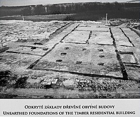
The castra in Mušov originated as a Roman army camp. Its name is unknown (possibly, but uncertainly, it was Eburon, from Ptolemy's Eβυρον). Romans made it his base of operations in the campaigns against Maroboduus (Marbod). So far the important in the Europe-wide context remains the unique site encompassing large variety of evidences of the period of the Marcomannic Wars (166-180 AD) - the central military base on the hill Hradisko (Hillfort) at Mušov (now cadastral area of Pasohlávky). It was built by the Marcus Aurelius' soldiers deep inside the enemy territory, roughly 86 km to the north of the antique Vindobona (today Vienna). The base covers flat minor hilltop, superelevated by 50 m above surrounding terrain, and its southern mild slopes, on the banks of the river Dyje (Thaya). From this strategically situated location was possible to control and manage crossings of river (fort) and overland routes at the confluence of the rivers Svratka, Svitava and Dyje (Thaya) as well as surrounding areas along the rivers, densely populated by the Germanic tribes of Marcomanii.
...
Wikipedia

