Rockville (Vernon)
| Rockville, Connecticut | |
|---|---|
| Census-designated place | |

Downtown Rockville from Fox Hill in 2015
|
|
| Etymology: "Going to the Rock" | |
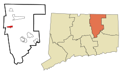
 Location in Tolland County, then Tolland County's location in Connecticut |
|
| Coordinates: 41°52′02″N 72°26′54″W / 41.8673°N 72.4483°WCoordinates: 41°52′02″N 72°26′54″W / 41.8673°N 72.4483°W | |
| Country |
|
| State |
|
| Town | Vernon |
| Area | |
| • Total | 5 km2 (1.8 sq mi) |
| • Land | 4.6 km2 (1.76 sq mi) |
| • Water | 0.1 km2 (0.04 sq mi) |
| Population (2010) | |
| • Total | 7,474 |
| • Estimate (2014) | 7,348 |
| • Density | 752.1/km2 (1,947.9/sq mi) |
| Time zone | Eastern Time Zone (UTC-5) |
| • Summer (DST) | Eastern Daylight Time (UTC-4) |
| Postal Code | 06066 |
| Area code(s) | 860 |
| Website | rockvillect |
|
Rockville Historic District
|
|

George Maxwell Memorial Library, photograph from 2006
|
|
| Location | Roughly bounded by Snipsic St., Davis Ave., West and South Sts., Rockville, Connecticut |
| Coordinates | 41°51′51″N 72°27′4″W / 41.86417°N 72.45111°W |
| Area | 550 acres (220 ha) |
| Architect | Platt,Charles A. et al |
| Architectural style | Greek Revival, Late Victorian, Classical Revival |
| NRHP Reference # | 84001173 |
| Added to NRHP | September 13, 1984 |
Rockville is a census-designated place and a village of the town of Vernon in Tolland County, Connecticut, United States. The population was 7,474 at the 2010 census. Incorporated as a city in 1889, it has been consolidated with the town of Vernon since 1965.
According to the United States Census Bureau, the CDP has a total area of 1.8 square miles (4.7 km2), of which, 1.7 square miles (4.4 km2) of it is land and 0.04 square miles (0.10 km2) of it (1.70%) is water.
In 1726, Samuel Grant traded his farm in Bolton for 500 acres (2.0 km2) in the northern part of Bolton. This included the area which is now known as "Rockville" and for about the next century it was a nameless village. A prominent feature of the area is the Shenipsit Lake, or "The Snip" as it is currently affectionately called by the residents. The Snip feeds the Hockanum River which cascades 254 feet over 1.5 miles (2.4 km). The river was used by the farmers for a grist mill, a saw mill, an oil mill and even a distillery starting around 1740.
In 1821, Colonel Francis McLean built the first textile mill in what is now Rockville in partnership with George and Allyn Kellogg and Ralph Talcott, next to a spot known as "the Rock" with capital of $16,000. Francis McLean had partnered previously with some others in the Warburton Mill in Talcottville. "The Rock" was a natural dam of solid stone that made a high falls on the Hockanum River. In what is now the center of Rockville, he dammed up the Hockanum River and built a water powered mill known as the "Rock Mill", which was possibly also known as the McLean Woolen Factory. By 1823 his mill was in full operation. The new mill was 80 by 30 feet, and its product was blue and blue-mix satinet. In 1826 power looms were introduced.
...
Wikipedia


