
Rocknest (Mars)

"Rocknest" sand patch on Mars (September 28, 2012).
|
|
| Feature type | Sand Patch |
|---|---|
| Coordinates | 4°35′S 137°26′E / 4.59°S 137.44°ECoordinates: 4°35′S 137°26′E / 4.59°S 137.44°E |
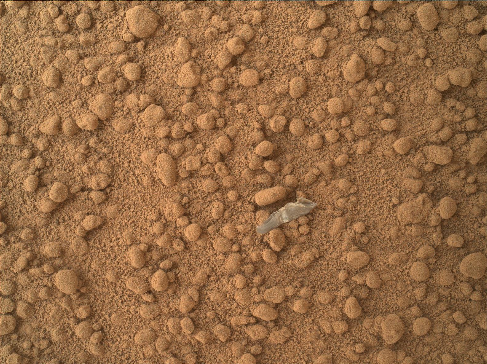
Rocknest is a sand patch on the surface of Aeolis Palus, between Peace Vallis and Aeolis Mons ("Mount Sharp"), in Gale crater on the planet Mars. The patch was encountered by the Curiosity rover on the way from Bradbury Landing to Glenelg Intrigue on September 28, 2012. The "approximate" site coordinates are: 4°35′S 137°26′E / 4.59°S 137.44°E.
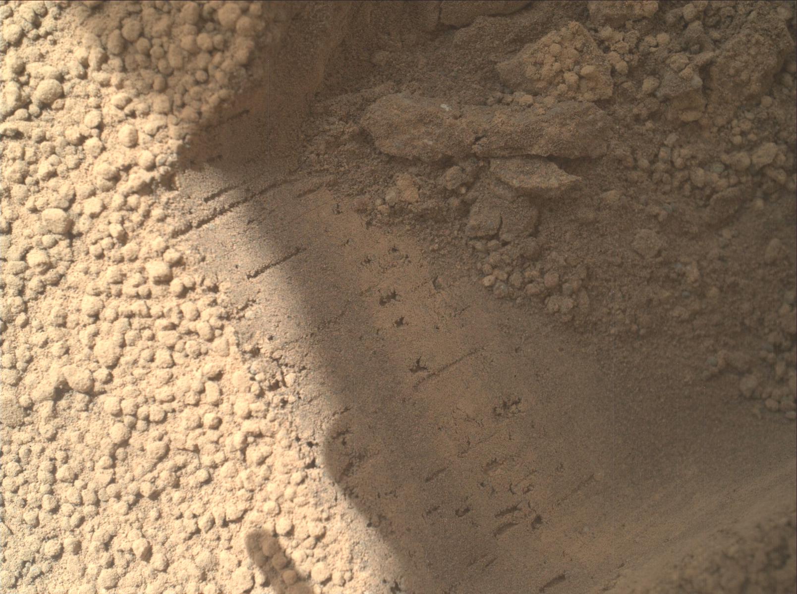
The sand patch is downhill from a cluster of dark rocks. NASA determined the patch to be the location for the first use of the scoop on the arm of the Mars Curiosity rover. The "Rocknest" patch is about 1.5 m (4.9 ft) by 5 m (16 ft).
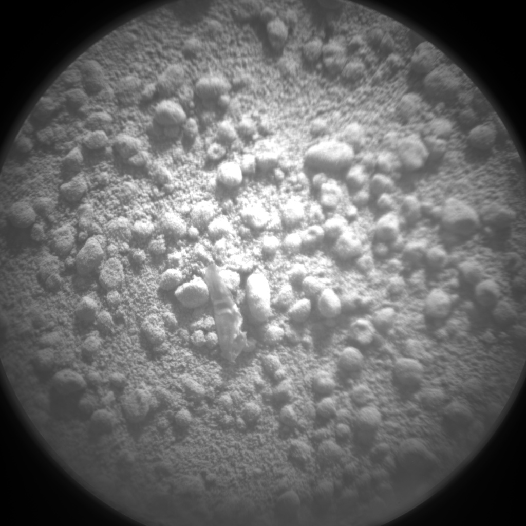
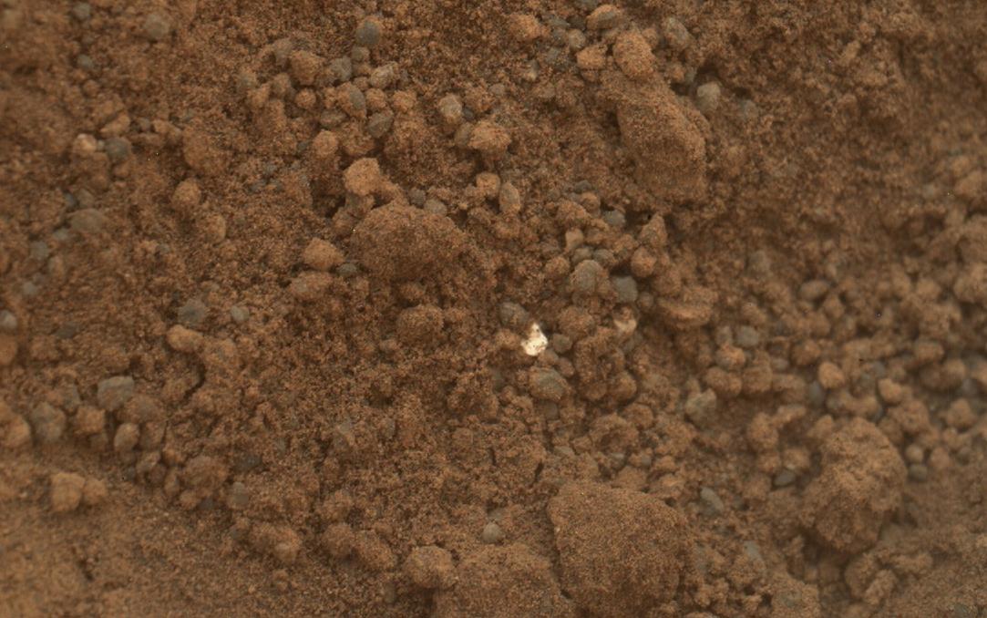
On October 7, 2012, a mysterious "bright object" (image), discovered in the sand at Rocknest, drew scientific interest. Several close-up pictures (close-up 1) (close-up 2) were taken of the object and preliminary interpretations by scientists suggest the object to be "debris from the spacecraft". Nonetheless, further images in the nearby sand have detected other "bright particles" (image) (close-up 1). These newly discovered objects are presently thought to be "native Martian material".
...
Wikipedia