Rock Springs, Wisconsin
| Rock Springs, Wisconsin | |
|---|---|
| Village | |

Looking east in Rock Springs
|
|
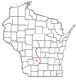
 Location of Rock Springs, Wisconsin |
|
| Coordinates: 43°28′40″N 89°55′1″W / 43.47778°N 89.91694°WCoordinates: 43°28′40″N 89°55′1″W / 43.47778°N 89.91694°W | |
| Country | United States |
| State | Wisconsin |
| County | Sauk |
| Area | |
| • Total | 1.35 sq mi (3.50 km2) |
| • Land | 1.32 sq mi (3.42 km2) |
| • Water | 0.03 sq mi (0.08 km2) |
| Elevation | 974 ft (297 m) |
| Population (2010) | |
| • Total | 362 |
| • Estimate (2012) | 360 |
| • Density | 274.2/sq mi (105.9/km2) |
| Time zone | Central (CST) (UTC-6) |
| • Summer (DST) | CDT (UTC-5) |
| Area code(s) | 608 |
| FIPS code | 55-68975 |
| GNIS feature ID | 1572475 |
Rock Springs is a village in Sauk County, Wisconsin, United States, along the Baraboo River. The population was 362 at the 2010 census.
At the time of its founding, Rock Springs was known as Ableman, after Stephen Van Rensselaer Ableman, who settled there in 1851. The railroad has been a major influence on the village's growth.
Surrounded by cliffs of Baraboo Quartzite, the village is two miles south of a notable rock formation located in Ableman Gorge, Van Hise Rock, which was used to explain the processes of structural geology by University of Wisconsin-Madison professor Charles R. Van Hise.
Rock Springs is located at 43°28′40″N 89°55′1″W / 43.47778°N 89.91694°W (43.477698, -89.917030).
According to the United States Census Bureau, the village has a total area of 1.35 square miles (3.50 km2), of which, 1.32 square miles (3.42 km2) of it is land and 0.03 square miles (0.08 km2) is water.
As of the census of 2010, there were 362 people, 137 households, and 99 families residing in the village. The population density was 274.2 inhabitants per square mile (105.9/km2). There were 150 housing units at an average density of 113.6 per square mile (43.9/km2). The racial makeup of the village was 96.4% White, 1.1% Native American, and 2.5% from two or more races. Hispanic or Latino of any race were 0.8% of the population.
...
Wikipedia
