Rivière-du-Loup, Quebec
| Rivière-du-Loup | ||
|---|---|---|
| City | ||

Rivière-du-Loup at sunset
|
||
|
||
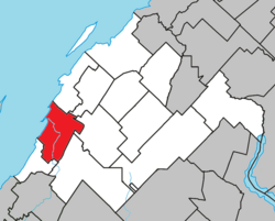
 Location within Rivière-du-Loup RCM |
||
| Location in eastern Quebec | ||
| Coordinates: 47°50′N 69°32′W / 47.833°N 69.533°WCoordinates: 47°50′N 69°32′W / 47.833°N 69.533°W | ||
| Country |
|
|
| Province |
|
|
| Region | Bas-Saint-Laurent | |
| RCM | Rivière-du-Loup | |
| Settled | 1850 as Fraserville | |
| Constituted | December 30, 1998 | |
| Government | ||
| • Mayor | Gaétan Gamache | |
| • Federal riding | Montmagny—L'Islet—Kamouraska—Rivière-du-Loup | |
| • Prov. riding | Rivière-du-Loup–Témiscouata | |
| Area | ||
| • City | 138.40 km2 (53.44 sq mi) | |
| • Land | 84.23 km2 (32.52 sq mi) | |
| • Urban | 17.77 km2 (6.86 sq mi) | |
| • Metro | 472.91 km2 (182.59 sq mi) | |
| Population (2011) | ||
| • City | 19,447 | |
| • Density | 230.9/km2 (598/sq mi) | |
| • Urban | 17,086 | |
| • Urban density | 961.3/km2 (2,490/sq mi) | |
| • Metro | 27,734 | |
| • Metro density | 58.6/km2 (152/sq mi) | |
| • Pop 2006-2011 |
|
|
| • Dwellings | 9,537 | |
| Time zone | EST (UTC−5) | |
| • Summer (DST) | EDT (UTC−4) | |
| Postal code(s) | G5R | |
| Area code(s) | 418 and 581 | |
| Highways |
|
|
| Website | www |
|
Rivière-du-Loup (2011 population 19,447) is a small city on the south shore of the Saint Lawrence River in Quebec. The city is the seat for the Rivière-du-Loup Regional County Municipality and the judicial district of Kamouraska.
The city was named after the nearby river, whose name means Wolf's River in French. This name may have come from a native tribe known as "Les Loups" or from the many seals, known in French as loup-marin (sea wolves), once found at the river's mouth.
Rivière-du-Loup was originally established in 1673 as the seigneurie of Sieur Charles-Aubert de la Chesnaye. The community was incorporated as the village of Fraserville, in honour of early English settler Alexandre Fraser, in 1850, and became a city in 1910. The city reverted to its original name, Rivière-du-Loup, in 1919.
Between 1850 and 1919, the city saw large increases in its anglophone population. Most of them left the region by the 1950s. 1% of the population still speaks English as its first language.
In fall of 1950 Rivière-du-Loup was the site of a nuclear accident. A USAF B-50 was returning a nuclear bomb to the USA. The bomb was released due to engine troubles, and then was destroyed in a non-nuclear detonation before it hit the ground. The explosion scattered nearly 100 pounds (45 kg) of uranium (U-238).
The city is known for its spectacular sunsets.
Rivière-du-Loup is a traditional stopping point between Quebec City, the Maritimes and the Gaspé Peninsula. The Trans-Canada Highway turns south here, transferring from Autoroute 20 to Autoroute 85 and continuing southerly to Edmundston, New Brunswick.
...
Wikipedia


