Riverside, Washington
| Riverside | |
|---|---|
| Town | |
| Riverside, Washington | |

Riverside City Hall
|
|
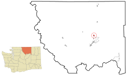
 Location of Riverside, Washington |
|
| Coordinates: 48°30′10″N 119°30′31″W / 48.50278°N 119.50861°WCoordinates: 48°30′10″N 119°30′31″W / 48.50278°N 119.50861°W | |
| Country | United States |
| State | Washington |
| County | Okanogan |
| Area | |
| • Total | 0.99 sq mi (2.56 km2) |
| • Land | 0.97 sq mi (2.51 km2) |
| • Water | 0.02 sq mi (0.05 km2) |
| Elevation | 866 ft (264 m) |
| Population (2010) | |
| • Total | 280 |
| • Estimate (2015) | 271 |
| • Density | 288.7/sq mi (111.5/km2) |
| Time zone | Pacific (PST) (UTC-8) |
| • Summer (DST) | PDT (UTC-7) |
| ZIP code | 98849 |
| Area code(s) | 509 |
| FIPS code | 53-58795 |
| GNIS feature ID | 1531498 |
Riverside is a town in Okanogan County, Washington, United States. The population was 348 at the 2000 census and decreased to 280 at the 2010 census.
Riverside was first settled in the 1880s by Uriah Ward. When steamboats began traveling up the Okanogan River, Riverside was the upstream limit of navigation during the high water season. Riverside was officially incorporated on December 22, 1913.
Riverside is located at 48°30′10″N 119°30′31″W / 48.50278°N 119.50861°W (48.502830, -119.508718). According to the United States Census Bureau, the town has a total area of 0.99 square miles (2.56 km2), of which, 0.97 square miles (2.51 km2) is land and 0.02 square miles (0.05 km2) is water. Sometimes considered to be part of Greater Omak, it is home to the Omak Airport.
As of the census of 2010, there were 280 people, 128 households, and 78 families residing in the town. The population density was 288.7 inhabitants per square mile (111.5/km2). There were 154 housing units at an average density of 158.8 per square mile (61.3/km2). The racial makeup of the town was 87.1% White, 7.5% Native American, 1.8% from other races, and 3.6% from two or more races. Hispanic or Latino of any race were 6.4% of the population.
...
Wikipedia
