Riverlea, Ohio
| Riverlea, Ohio | |
|---|---|
| Village | |

Mark Russell House on High Street
|
|
 Location of Riverlea within Ohio |
|
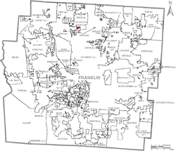
 Location of Riverlea within Franklin County |
|
| Coordinates: 40°4′52″N 83°1′28″W / 40.08111°N 83.02444°WCoordinates: 40°4′52″N 83°1′28″W / 40.08111°N 83.02444°W | |
| Country | United States |
| State | Ohio |
| County | Franklin |
| Area | |
| • Total | 0.15 sq mi (0.39 km2) |
| • Land | 0.15 sq mi (0.39 km2) |
| • Water | 0 sq mi (0 km2) |
| Elevation | 787 ft (240 m) |
| Population (2010) | |
| • Total | 545 |
| • Estimate (2012) | 555 |
| • Density | 3,633.3/sq mi (1,402.8/km2) |
| Time zone | Eastern (EST) (UTC-5) |
| • Summer (DST) | EDT (UTC-4) |
| ZIP code | 43085 |
| Area code(s) | 614 |
| FIPS code | 39-67440 |
| GNIS feature ID | 1056491 |
| Website | www.riverleaohio.com |
Riverlea is a village in Franklin County, Ohio, United States, surrounded by Worthington on its north, south, and east sides, and bordered on the west by the Olentangy River, across which is in Columbus. Riverlea was incorporated in 1939, a small community that formed on former farmland. The population was 545 at the 2010 census.
In 2011, Riverlea and Worthington explored the possibility of the annexation of Riverlea to Worthington. Riverlea voters defeated the annexation.
Riverlea is located at 40°4′52″N 83°1′28″W / 40.08111°N 83.02444°W (40.081054, -83.024379).
According to the United States Census Bureau, the village has a total area of 0.15 square miles (0.39 km2), all land.
Worthington and Riverlea form an enclave of Columbus.
As of the census of 2010, there were 545 people, 221 households, and 153 families residing in the village. The population density was 3,633.3 inhabitants per square mile (1,402.8/km2). There were 236 housing units at an average density of 1,573.3 per square mile (607.5/km2). The racial makeup of the village was 97.1% White, 0.4% African American, 0.2% Native American, 1.5% Asian, and 0.9% from two or more races. Hispanic or Latino of any race were 0.6% of the population.
...
Wikipedia
