Riesling Trail
| Riesling Trail | |
|---|---|

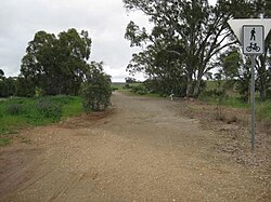
Riesling Trail, looking to the north, near Leasingham
|
|
| Established | 1995 |
| Length | 35 kilometres (22 miles) |
| Location | Clare Valley |
| Trailheads | |
| Use | Walking, cycling |
The Riesling Trail is a 35 kilometres (22 miles) long walking and cycling track located in the Clare Valley, South Australia. Established for recreational purposes, it runs between Auburn and Clare, passing through several towns and villages along the way, including Leasingham, Watervale, Penwortham and Sevenhill. The trail is named after Riesling, the most important white grape variety in the Clare Valley wine region.
A recent extension now extends 8 kilometres (5.0 miles) north of Clare to the area known as Barinia. Interpretative signage exists at many spots along the trail, there are picnic tables and seats at several places, and at Watervale a small shelter and rainwater tank provides for the needs for trail users.
The Riesling Trail originally utilised part of the Spalding railway line branch line which ran between Riverton in the south to a northern terminus at Spalding. The section of railway from Riverton to Clare was opened in 1918. Railway stations and sidings along the section of line between Auburn and Spalding were: Rhynie, Undalya, Auburn, Mulkirri, Watervale, Penwortham, Tatkana, Sevenhill, Clare, Kooramo, Barinia, Hilltown, Andrews, and Spalding.
Rail services ceased after the 1983 Ash Wednesday bushfires burnt through the valley and damaged a lot of the trackwork. In 1989 the rails and steel bridges were removed and in 1993, this part of the route was converted into its present use as a walking and cycle trail.
...
Wikipedia
