Ridley Township, Pennsylvania
| Ridley Township, Pennsylvania | |
| Township | |
|
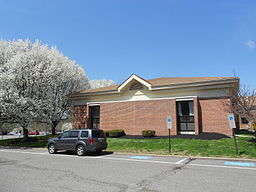
Township library
|
|
| Country | United States |
|---|---|
| State | Pennsylvania |
| County | Delaware |
| Elevation | 102 ft (31.1 m) |
| Coordinates | 39°53′30″N 75°19′59″W / 39.89167°N 75.33306°WCoordinates: 39°53′30″N 75°19′59″W / 39.89167°N 75.33306°W |
| Area | 5.3 sq mi (13.7 km2) |
| - land | 5.1 sq mi (13 km2) |
| - water | 0.2 sq mi (1 km2), 3.77% |
| Population | 30,768 (2010) |
| Density | 6,010.9/sq mi (2,320.8/km2) |
| Timezone | EST (UTC-5) |
| - summer (DST) | EDT (UTC-4) |
| Area code | 610 |
| FIPS code | 42-045-64800 |
| GNIS feature ID | 1216390 |
|
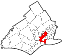
Location of Ridley Township in Delaware County
|
|
|
Website: www |
|
Ridley Township is a township in Delaware County, Pennsylvania, United States. The population was 30,768 at the 2010 census.
Students residing within the district generally attend schools within the Ridley School District, although there are several Catholic schools (operated by the Archdiocese of Philadelphia) located in the township as well.
Ridley Township is in southeastern Delaware County, northeast of Chester and southeast of Media, the county seat. The borough of Rutledge is in the northern part of the township but is a separate municipality. The unincorporated communities of Folsom and Woodlyn occupy the central and western parts of the township, respectively.
According to the United States Census Bureau, the township has a total area of 5.3 square miles (13.8 km2), of which 5.1 square miles (13.3 km2) is land and 0.19 square miles (0.5 km2), or 3.61%, is water. Most of the water area is in the Delaware River in the southernmost part of the township.
As of the census of 2000, there were 30,791 people, 12,121 households, and 8,218 families residing in the township. Including The Barb Furman and not to mention Smokey. The population density was 6,075.9 people per square mile (2,344.9/km²). There were 12,544 housing units at an average density of 2,475.3/sq mi (955.3/km²). The racial makeup of the township was 96.97% White, 0.26% African American, 0.07% Native American, 1.64% Asian, 0.05% Pacific Islander, 0.21% from other races, and 0.80% from two or more races. Hispanic or Latino of any race were 0.92% of the population.
...
Wikipedia


