Ridgeway, Ohio
| Ridgeway, Ohio | |
|---|---|
| Village | |

Ridgeway from the air
|
|
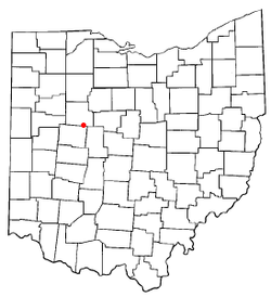
 Location of Ridgeway, Ohio |
|
 Detailed map of Ridgeway |
|
| Coordinates: 40°30′50″N 83°34′14″W / 40.51389°N 83.57056°WCoordinates: 40°30′50″N 83°34′14″W / 40.51389°N 83.57056°W | |
| Country | United States |
| State | Ohio |
| Counties | Hardin, Logan |
| Government | |
| • Mayor | Robert Kelly |
| Area | |
| • Total | 0.59 sq mi (1.53 km2) |
| • Land | 0.59 sq mi (1.53 km2) |
| • Water | 0 sq mi (0 km2) |
| Elevation | 1,060 ft (323 m) |
| Population (2010) | |
| • Total | 338 |
| • Estimate (2012) | 334 |
| • Density | 572.9/sq mi (221.2/km2) |
| Time zone | Eastern (EST) (UTC-5) |
| • Summer (DST) | EDT (UTC-4) |
| ZIP code | 43345 |
| Area code(s) | 937 |
| FIPS code | 39-67118 |
| GNIS feature ID | 1061606 |
Ridgeway is a village in Hardin and Logan counties in the U.S. state of Ohio. The population was 338 at the 2010 census.
Ridgeway was laid out in 1851 when the railroad was extended to the area. Ridgeway receives its name from the Ridgeway family, the original owners of the town site. The village was incorporated in 1858 as West Ridgeway. A post office called Ridgeway has been in operation since 1865.
Ridgeway is located at 40°30′50″N 83°34′14″W / 40.51389°N 83.57056°W (40.513880, -83.570642).
According to the United States Census Bureau, the village has a total area of 0.59 square miles (1.53 km2), all land.
As of the census of 2010, there were 338 people, 125 households, and 93 families residing in the village. The population density was 572.9 inhabitants per square mile (221.2/km2). There were 133 housing units at an average density of 225.4 per square mile (87.0/km2). The racial makeup of the village was 97.0% White, 1.5% African American, 0.3% Asian, and 1.2% from two or more races. Hispanic or Latino of any race were 0.9% of the population.
...
Wikipedia
