Richfield, UT
| Richfield, Utah | |
|---|---|
| City | |

Sevier County Courthouse
|
|
| Nickname(s): Red Hill Country; Panoramaland | |
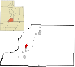
 Location within Sevier County and the State of Utah. |
|
| Coordinates: 38°45′57″N 112°5′15″W / 38.76583°N 112.08750°WCoordinates: 38°45′57″N 112°5′15″W / 38.76583°N 112.08750°W | |
| Country | United States |
| State | Utah |
| County | Sevier |
| Settled | 1864 |
| Founded by | Albert Lewis |
| Named for | Rich fields of wheat |
| Area | |
| • Total | 5.3 sq mi (13.7 km2) |
| • Land | 5.3 sq mi (13.7 km2) |
| • Water | 0.0 sq mi (0.0 km2) |
| Elevation | 5,354 ft (1,632 m) |
| Population (2010) | |
| • Total | 7,520 |
| • Density | 1,424.7/sq mi (551.2/km2) |
| Time zone | Mountain (MST) (UTC-7) |
| • Summer (DST) | MDT (UTC-6) |
| ZIP code | 84701 |
| Area code(s) | 435 |
| FIPS code | 49-63570 |
| GNIS feature ID | 1444889 |
| Website | www |
Richfield is a city in and the county seat of Sevier County, Utah, in the United States, and is the largest city in southern-central Utah.
As of the 2010 census, the city population was 7,551. It lies in the Mormon Corridor, just off Interstate 70 about 40 miles (64 km) east of its junction with Interstate 15. The county can be best described as "rural diversified" due to the convergence of agricultural, retail and industrial activities. Richfield has developed as a regional tourist center because it is located on the interstate freeway about halfway between Los Angeles, California and Denver, Colorado, attracting many automobile travelers who stop at the city.
Richfield is remote from larger cities, about 100 miles (160 km) or more in any direction from more populous towns, while dozens of smaller communities are found in the general area. Its remoteness, plus its location on major transportation corridors, makes it central Utah's de facto regional capital, a shopping and "commercial capital of a vast mountain-valley region." Many people from the region drive to Richfield to shop, bowl, golf, to attend theater, concerts, or for religious gatherings. They are also drawn to the community college, affiliated with Snow College, and go there to receive medical care. Richfield is part of "Panoramaland;" it is on the thoroughfare to several nearby national parks and national forests.
Prehistoric people occupied the Richfield area for more than 7,000 years. Fremont culture remains are found near most community sites in the Sevier area and are dated from approximately CE 1 to CE 1000. In the late summer of 1776, Father Escalante and his party of Spanish explorers passed through the general vicinity, looking for a trail to link Nuevo Mexico and California. During the late 1820s, Jedediah Smith and other fur traders crossed the area. Sevier County lies on one of the variants on the Old Spanish Trail between Santa Fe, New Mexico and California and was used by travelers between 1830 and 1850.
...
Wikipedia
