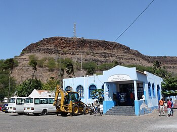
Ribeira Grande de Santiago, Cape Verde
| Ribeira Grande de Santiago | |
|---|---|
| Municipality | |

Municipal hall of Ribeira Grande de Santiago
|
|
 |
|
| Coordinates: 14°58′N 23°38′W / 14.97°N 23.64°WCoordinates: 14°58′N 23°38′W / 14.97°N 23.64°W | |
| Country | Cape Verde |
| Island | Santiago |
| Area | |
| • Total | 137.3 km2 (53.0 sq mi) |
| Population (2010) | |
| • Total | 8,323 |
| • Density | 61/km2 (160/sq mi) |
Ribeira Grande de Santiago is a concelho (municipality) of Cape Verde. It is situated in the southwestern part of the island of Santiago. Its seat is the town Cidade Velha. Its population was 8,323 at the 2010 census and is 18th in population. The area is 137.3 km², the twelfth largest in Cape Verde.
The municipality consists of two freguesias (civil parishes):
Its geography are nearly entirely mountainous, the southeast are dominated by the mountains, the northern part are mountainous, the western part features cliffs in the western part. One of the main streams of the area is Ribeira Grande de Santiago. The cliffs in the west were formed in around 73,000 BC as the 170 meter tall tsunami came from Fogo when the eastern part collapsed into the ocean, a part of the west of the island which were hilly and had not too many cliffs collapsed and eroded into the sea, land about 700 meters to 1 km wide and to 3 km was lost and its location was 100 meters from today's sea level, it did not cause major damage to the land around the modern municipality.
The municipality was created in 2005, when two parishes of the older Municipality of Praia were separated to become the Municipality of Ribeira Grande de Santiago.
The old city of Ribeira Grande de Santiago (Cidade Velha) is one of the oldest European settlements in Sub-Saharan Africa. It was an important port for the slave trade from West Africa to the Americas. The town has numerous protected significant buildings and ruins. The city and fort are listed in UNESCO's World Heritage Site since 2009.
The reservoir for Cidade Velha, Praia and the Southern Santiago Island Urban Area (the only two metropolitan areas in Cape Verde) started construction in around 2010 and finished on June 29, 2013, its location is 2 km north from Cidade Velha and nearly a kilometer from the hamlet of Salineiro.
The volcanic clouds of the 2014–15 eruption of Fogo was seen in most of the municipality except for the mountains and most of its valleys in the north in late November and up to mid December.
...
Wikipedia
