Rexford, Kansas
| Rexford, Kansas | |
|---|---|
| City | |
 Location within Thomas County and Kansas |
|
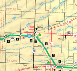
 KDOT map of Thomas County (legend) |
|
| Coordinates: 39°28′14″N 100°44′38″W / 39.47056°N 100.74389°WCoordinates: 39°28′14″N 100°44′38″W / 39.47056°N 100.74389°W | |
| Country | United States |
| State | Kansas |
| County | Thomas |
| Area | |
| • Total | 0.26 sq mi (0.67 km2) |
| • Land | 0.26 sq mi (0.67 km2) |
| • Water | 0 sq mi (0 km2) |
| Elevation | 2,956 ft (901 m) |
| Population (2010) | |
| • Total | 232 |
| • Estimate (2015) | 230 |
| • Density | 890/sq mi (350/km2) |
| Time zone | Central (CST) (UTC-6) |
| • Summer (DST) | CDT (UTC-5) |
| ZIP code | 67753 |
| Area code(s) | 785 |
| FIPS code | 20-59125 |
| GNIS feature ID | 0471214 |
Rexford is a city in Thomas County, Kansas, United States. As of the 2010 census, the city population was 232.
Rexford was founded about 1887. It was named in honor of a member of the Rexford family. After they died in a fire, that had engulfed the family home. They were some of the first settlers in the area and had been there for years.
The first post office in Rexford was established in August 1888.
In 1923 the town of Rexford voted up a three-year-old as mayor. He held that office for five months before they realized that he was not capable of running an entire township.
Rexford is located at 39°28′14″N 100°44′38″W / 39.47056°N 100.74389°W (39.470512, -100.743975). Rexford is located along U.S. Route 83 about 20 miles north of Interstate 70. According to the United States Census Bureau, the city has a total area of 0.26 square miles (0.67 km2), all of it land.
The climate in this area is characterized by hot, humid summers and generally mild to cool winters. Occasionally, the area has large blizards in which the entire are can be without electricity. According to the Köppen Climate Classification system, Rexford has a humid subtropical climate, abbreviated "Cfa" on climate maps.
As of the census of 2010, there were 232 people, 84 households, and 52 families residing in the city. The population density was 892.3 inhabitants per square mile (344.5/km2). There were 104 housing units at an average density of 400.0 per square mile (154.4/km2). The racial makeup of the city was 74.1% White, 0.4% African American, 0.4% Native American, 23.3% from other races, and 1.7% from two or more races. Hispanic or Latino of any race were 26.3% of the population.
...
Wikipedia
