Reimerswaal (municipality)
| Reimerswaal | |||
|---|---|---|---|
| Municipality | |||

Krabbendijke town centre
|
|||
|
|||
 Location in Zeeland |
|||
| Coordinates: 51°27′N 4°2′E / 51.450°N 4.033°ECoordinates: 51°27′N 4°2′E / 51.450°N 4.033°E | |||
| Country | Netherlands | ||
| Province | Zeeland | ||
| Government | |||
| • Body | Municipal council | ||
| • Mayor | Jan Huisman (CDA) | ||
| Area | |||
| • Total | 242.42 km2 (93.60 sq mi) | ||
| • Land | 101.99 km2 (39.38 sq mi) | ||
| • Water | 140.43 km2 (54.22 sq mi) | ||
| Elevation | 1 m (3 ft) | ||
| Population (February 2017) | |||
| • Total | 21,999 | ||
| • Density | 216/km2 (560/sq mi) | ||
| Time zone | CET (UTC+1) | ||
| • Summer (DST) | CEST (UTC+2) | ||
| Postcode | 4400–4419 | ||
| Area code | 0113 | ||
| Website | www |
||
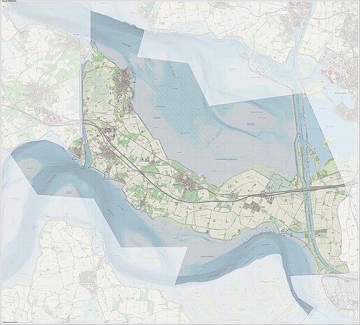
Reimerswaal (![]() pronunciation ) is a municipality in the province of Zeeland in the southwestern Netherlands on Zuid-Beveland, named after the lost city. The municipality had a population of 21,999 in 2017, and has a surface area of 242.42 km2 (93.60 sq mi) of which 140.43 km2 (54.22 sq mi) is water. The central town Yerseke is known for trade in mussels and oysters. Kruiningen is known for the former ferry from Kruiningen to Perkpolder which was in service up to 2003. The municipality of Reimerswaal was established in 1970, from the aggregation of the municipalities Krabbendijke, Kruiningen, Rilland-Bath, Waarde, and Yerseke.
pronunciation ) is a municipality in the province of Zeeland in the southwestern Netherlands on Zuid-Beveland, named after the lost city. The municipality had a population of 21,999 in 2017, and has a surface area of 242.42 km2 (93.60 sq mi) of which 140.43 km2 (54.22 sq mi) is water. The central town Yerseke is known for trade in mussels and oysters. Kruiningen is known for the former ferry from Kruiningen to Perkpolder which was in service up to 2003. The municipality of Reimerswaal was established in 1970, from the aggregation of the municipalities Krabbendijke, Kruiningen, Rilland-Bath, Waarde, and Yerseke.
...
Wikipedia


