Regina International Airport
| Regina International Airport | |||||||||||||||
|---|---|---|---|---|---|---|---|---|---|---|---|---|---|---|---|
 |
|||||||||||||||
 |
|||||||||||||||
| Summary | |||||||||||||||
| Airport type | Public | ||||||||||||||
| Owner | Transport Canada | ||||||||||||||
| Operator | Regina Airport Authority | ||||||||||||||
| Serves | Regina, Saskatchewan | ||||||||||||||
| Time zone | CST (UTC−06:00) | ||||||||||||||
| Elevation AMSL | 1,895 ft / 578 m | ||||||||||||||
| Coordinates | 50°25′56″N 104°39′58″W / 50.43222°N 104.66611°WCoordinates: 50°25′56″N 104°39′58″W / 50.43222°N 104.66611°W | ||||||||||||||
| Website | www |
||||||||||||||
| Map | |||||||||||||||
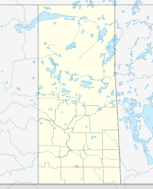
| Location in Saskatchewan | |||||||||||||||
| Runways | |||||||||||||||
|
|||||||||||||||
| Statistics (2016) | |||||||||||||||
|
|||||||||||||||
|
Sources: Canada Flight Supplement
Environment Canada Transport Canada Movements from Statistics Canada Passenger statistics from Regina Airport Authority |
|||||||||||||||
| Aircraft movements | 58,168 |
|---|---|
| Passengers | 1,262,899 |
Regina International Airport (IATA: YQR, ICAO: CYQR) is an international airport located in Regina, Saskatchewan, Canada, located 2 nautical miles (3.7 km; 2.3 mi) south-west and 7 km (4.3 mi) west south-west of the city centre. It is run by the Regina Airport Authority. It was, in 2010, the second busiest airport in Saskatchewan (Saskatoon John G. Diefenbaker being the busiest).
The airport is classified as an airport of entry by Nav Canada and is staffed by the Canada Border Services Agency (CBSA). CBSA officers at this airport can handle aircraft with no more than 120 passengers. However, they can handle up to 250 if the aircraft is unloaded in stages.
The first site in Regina used for flying was the infield at Regina Exhibition Park's horse race track, where visiting barnstormer "Lucky Bob" St. Pierre (a Nebraskan whose real name was "Shaeffer" or "Shaffer") flew a Curtiss Model D biplane in August, 1911. A few other barnstormers, notably aviator Katherine Stinson of the famous aviation family, appeared in Regina and other prairie cities in the years thereafter, but there was virtually no other aviation activity in Western Canada during the First World War.
After the First World War, Reginan Roland Groome returned from military service as a flying instructor in Southern Ontario and, with partners, set up a company called the "Aerial Service Co." Its primitive airfield was located near what is the current intersection of Hill Avenue and Cameron Street in the city's southern Lakeview district. In May 1920, federal government regulators assigned this field the designation of Canada 's first licensed "air harbour". Groome also received Canadian commercial pilot's licence No. 1 and mechanic Robert McCombie was given air engineer's licence No. 1.
...
Wikipedia


