Redstone Township, Fayette County, Pennsylvania
| Redstone Township | |
|---|---|
| Township | |

Dunlap's Creek Presbyterian Church at Merrittstown, organized 1774
|
|
 Location of Redstone Township in Fayette County |
|
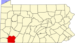
 Location of Fayette County in Pennsylvania |
|
| Country | United States |
| State | Pennsylvania |
| County | Fayette |
| Area | |
| • Total | 22.82 sq mi (59.11 km2) |
| • Land | 22.76 sq mi (58.95 km2) |
| • Water | 0.06 sq mi (0.16 km2) |
| Population (2010) | |
| • Total | 5,566 |
| • Density | 244/sq mi (94.4/km2) |
| Time zone | EST (UTC-4) |
| • Summer (DST) | EDT (UTC-5) |
| Area code(s) | 724 |
| Website | www |
Redstone Township is a township in Fayette County, Pennsylvania, United States. The population was 5,566 at the 2010 census, down from 6,397 at the 2000 census. The Brownsville Area School District serves the region.
Communities in the township include Rowes Run, Republic, Allison, Chestnut Ridge, Fairbank, Cardale, Royal, Merrittstown, Herbert, and a small portion of Grindstone.
The Brier Hill, Peter Colley Tavern and Barn, Johnson-Hatfield Tavern, Hugh Laughlin House, and Wallace-Baily Tavern are listed on the National Register of Historic Places.
Redstone Township is in western Fayette County. Redstone Creek, a tributary of the Monongahela River, forms the northern border of the township. U.S. Route 40 (the National Road) and Pennsylvania Route 43 (the Mon–Fayette Expressway) cross the township, both leading southeast to Uniontown, the Fayette County seat. US 40 leads northwest into Brownsville on the Monongahela, while PA 43 leads west then north into Centerville.
...
Wikipedia
