Redlands (CA)
| City of Redlands | ||
|---|---|---|
| General law city | ||
|
||
| Nickname(s): "Jewel of the Inland Empire" | ||
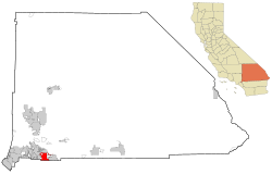
 Location of Redlands in California |
||
| Location in the United States | ||
| Coordinates: 34°3′17″N 117°10′57″W / 34.05472°N 117.18250°WCoordinates: 34°3′17″N 117°10′57″W / 34.05472°N 117.18250°W | ||
| Country |
|
|
| State |
|
|
| County | San Bernardino | |
| Incorporated | December 3, 1888 | |
| Government | ||
| • Type | Council-Manager | |
| • Mayor | Paul Foster | |
| Area | ||
| • Total | 36.33 sq mi (94.10 km2) | |
| • Land | 36.03 sq mi (93.32 km2) | |
| • Water | 0.30 sq mi (0.78 km2) 0.83% | |
| Elevation | 1,358 ft (414 m) | |
| Population (2010) | ||
| • Total | 68,747 | |
| • Estimate (2016) | 71,288 | |
| • Density | 1,978.52/sq mi (763.90/km2) | |
| Time zone | Pacific (UTC-8) | |
| • Summer (DST) | PDT (UTC-7) | |
| ZIP codes | 92373–92374 | |
| Area code | 909 | |
| FIPS code | 06-59962 | |
| GNIS feature IDs | 0252966, 2411532 | |
| Website | www |
|
Redlands /ˈrɛdlɪndz/ is a city in San Bernardino County, California, United States. It is a part of the Greater Los Angeles area. As of the 2010 census, the city had a population of 68,747, up from 63,591 at the 2000 census. The population was estimated at 69,999 in 2013. The city is located approximately 10 miles (16 km) east of downtown San Bernardino.
The area now occupied by Redlands was originally part of the territory of the Morongo and Aguas Calientes tribes of Cahuilla people. Explorations such as those of Pedro Fages and Francisco Garcés sought to extend Catholic influence to the indigenous people and the dominion of the Spanish crown into the area in the 1770s. The Serrano (Mountain-dwelling Cahuilla) village of Guachama, located just to the west of present-day Redlands, was visited by Fr. Francisco Dumetz in 1810, and was the reason the site was chosen for a mission outpost. Dumetz reached the village on May 20, the feast day of Saint Bernardino of Siena, and thus named the region the San Bernardino Valley. The Franciscan friars from Mission San Gabriel established the San Bernardino Asistencia in 1819 and embarked on the usual program of training the native tribes to raise crops and encouraging permanent settlements. By 1820, a ditch, known as a zanja, was dug by the natives for the friars from Mill Creek to the Asistencia. In 1822, word of the Mexican triumph in the War of Independence reached the inland area, and lands previously claimed by Spain passed to the custody of the Mexican government.
...
Wikipedia


