Rangitoto Island
| Maori: Rangitoto | |
|---|---|

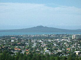
Rangitoto Island from One Tree Hill
|
|
| Geography | |
| Location | Auckland |
| Coordinates | 36°47′12″S 174°51′36″E / 36.786742°S 174.860115°E |
| Highest point | 260 m (850 ft) |
| Administration | |
|
New Zealand
|
|
Rangitoto Island is a volcanic island in the Hauraki Gulf near Auckland, New Zealand. The 5.5 km wide island is an iconic and widely visible landmark of Auckland with its distinctive symmetrical shield volcano cone rising 260 metres (850 ft) high over the Hauraki Gulf. Rangitoto is the most recent and the largest (2311 hectares) of the approximately 50 volcanoes of the Auckland volcanic field. It is separated from the mainland of Auckland's North Shore by the Rangitoto Channel. Since World War II it has been linked by a causeway to the much older, non-volcanic Motutapu Island.
Rangitoto is Māori for 'Bloody Sky', with the name coming from the full phrase Ngā Rangi-i-totongia-a Tama-te-kapua ('The days of the bleeding of Tama-te-kapua'). Tama-te-kapua was the captain of the Arawa waka (canoe) and was badly wounded on the island, at a (lost) battle with the Tainui iwi (tribe) at Islington Bay.
Rangitoto was formed by a series of eruptions commencing at least 6000 years ago. The most recent eruptions occurred between 550 and 600 years ago in two episodes, 10 to 50 years apart, and are thought to have lasted for several years during the later shield-forming episode. The first recent episode erupted most of the volcanic ash that mantles neighbouring Motutapu Island, and produced the lower, northern scoria cone. The second episode built most of Rangitoto, erupting all the lava flows and main scoria cone at the apex. The 2.3 cubic kilometres of material that erupted from the volcano was about equal to the combined mass produced by all the previous eruptions in the Auckland volcanic field, which were spread over more than 250,000 years.
In 2013, scientists said new studies showed Rangitoto had been much more active in the past than previously thought, suggesting it had been active on and off for around 1000 years before the final eruptions around 550 years ago. In February 2014 a 150m deep hole was drilled through the western flank of Rangitoto. This revealed a history of activity going back at least 6000 years, with the bulk of activity post-dating 3800 years. Civil Defence officials said the discovery did not make living in Auckland any more dangerous, but did change their view of how an evacuation might proceed. The fact that Rangitoto Island has erupted off and on for a long period of time demonstrates that it is the only known polygenetic volcano in the Auckland volcanic field. It is possible that Rangitoto includes a cluster of several small volcanoes that are now covered by the main shield.
...
Wikipedia

