Ramsey's Draft Wilderness
| Ramsey’s Draft Wilderness | |
| Part of George Washington National Forest | |
| Wilderness Area | |
| Country | United States |
|---|---|
| State | Virginia |
| County | Augusta |
| Elevation | 3,400 ft (1,036.3 m) |
| Coordinates | 38°20′00″N 79°20′42″W / 38.33333°N 79.34500°WCoordinates: 38°20′00″N 79°20′42″W / 38.33333°N 79.34500°W |
| Highest point | Hardscrabble Knob |
| - elevation | 4,282 ft (1,305.2 m) |
| Lowest point | |
| - elevation | 1,300 ft (396.2 m) |
| Area | 6,518 acres (2,637.7 ha) |
| Established | 1984 |
| Management | George Washington and Jefferson National Forests |
| Owner | USDA Forest Service |
| IUCN category | Ib - Wilderness Area |
| Nearest city | West Augusta, Virginia |
| Website: George Washington and Jefferson National Forests – Ramsey’s Draft Wilderness Area | |
Ramsey’s Draft Wilderness is a designated wilderness area in the North River Ranger District of the George Washington and Jefferson National Forests of Virginia in the United States. The wilderness area was established in 1984 and comprises 6,518 acres (26.38 km2). It is administered by the US Forest Service.
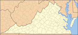
Ramsey’s Draft Wilderness is located between the crests of Shenandoah Mountain and Bald Ridge, north of U.S. Route 250 and approximately 20 miles (32 km) west of Staunton, Virginia. A rugged and steep piece of land, Ramsey’s Draft Wilderness ranges in elevation from 1,600 feet (488 m) to 4,282 feet (1,305 m) at Hardscrabble Knob. The wilderness is named after its primary drainage stream. A "draft," is a local term for a creek. Ramsey’s Draft is a tributary of the Calfpasture River, which feeds into the James River and the Chesapeake Bay.
The US Forest Service first purchased land in this area in 1913 for Shenandoah National Forest, the precursor to the present day George Washington National Forest. The Forest Service has managed the Ramsey’s Draft area essentially as a wilderness since 1935 as much of it had never been logged. A road more than three miles (5 km) upstream from U.S. 250 constructed by the Civilian Conservation Corps in the 1930s lasted until 1969, when rainwater from Hurricane Camille wiped out much of the road at the stream crossings. Another flood in November 1985 further eliminated the original road and changed the course of the stream in multiple areas, shortly after the area was officially designated a wilderness under the Virginia Wilderness Act of 1984.
The boundaries of Ramsey’s Draft wilderness have long been the subject of discussion. The original wilderness proposal, developed in the early 1970s and backed by the Virginia Wilderness Committee and the Potomac Chapter of the Sierra Club, included most of Shenandoah Mountain between Rt. 250 and FDR 95, the western slope down to private land along Shaws Fork, and much of the Bald Ridge area. The U.S. Forest Service recommended the core ~6,500 acres, and this is the tract that became law.
...
Wikipedia

