Ramey, Pennsylvania
| Ramey, Pennsylvania | |
|---|---|
| Borough | |

Ramey, Pennsylvania
|
|
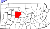
 Location of Ramey in Clearfield County |
|
 Location of Clearfield County in Pennsylvania |
|
| Location in Pennsylvania | |
| Coordinates: 40°48′01″N 78°24′05″W / 40.80028°N 78.40139°WCoordinates: 40°48′01″N 78°24′05″W / 40.80028°N 78.40139°W | |
| Country | United States |
| State | Pennsylvania |
| County | Clearfield |
| Incorporated | 1878 |
| Government | |
| • Type | Borough Council |
| Area | |
| • Total | 0.93 sq mi (2.41 km2) |
| • Land | 0.93 sq mi (2.40 km2) |
| • Water | 0.004 sq mi (0.01 km2) |
| Elevation | 1,613 ft (492 m) |
| Population (2010) | |
| • Total | 451 |
| • Density | 486/sq mi (187.7/km2) |
| Time zone | Eastern (EST) (UTC-5) |
| • Summer (DST) | EDT (UTC-4) |
| ZIP code | 16671 |
| Area code(s) | 814 |
Ramey is a borough in Clearfield County, Pennsylvania, United States. The population was 451 at the 2010 census.
Ramey is located in southeastern Clearfield County at 40°48′1″N 78°24′5″W / 40.80028°N 78.40139°W (40.800186, -78.401307), at the intersection of Pennsylvania Routes 253 and 453. PA 253 leads northeast 3.5 miles (5.6 km) to Houtzdale, and PA 453 leads northwest 4 miles (6 km) to Madera. The two highways together lead southwest 3 miles (5 km) to Janesville.
According to the United States Census Bureau, the borough of Ramey has a total area of 0.93 square miles (2.4 km2), of which 0.004 square miles (0.01 km2), or 0.41%, is water.
As of the census of 2000, there were 525 people, 207 households, and 156 families residing in the borough. The population density was 584.8 people per square mile (225.2/km²). There were 222 housing units at an average density of 247.3 per square mile (95.2/km²). The racial makeup of the borough was 99.24% White, 0.38% Native American, and 0.38% from two or more races. Hispanic or Latino of any race were 0.95% of the population.
...
Wikipedia

