Raju Cutac
| Raju Cutac | |
|---|---|
| Rajutuna | |

Raju Cutac as seen from Lake Conococha
|
|
| Highest point | |
| Elevation | 5,355 m (17,569 ft) |
| Coordinates | 10°00′34″S 77°10′36″W / 10.00944°S 77.17667°WCoordinates: 10°00′34″S 77°10′36″W / 10.00944°S 77.17667°W |
| Geography | |
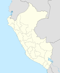
| Location | Peru, Ancash Region |
| Parent range | Andes, Cordillera Blanca |
| Climbing | |
| First ascent | 1962 |
Raju Cutac (possibly from Quechua rahu snow, ice, mountain with snow, Ancash Quechua kuta flour; corner, -q a suffix),Rajo Cutac or Rajutuna (possibly from Quechua tuna slope, "snow peak slope"), is a 5,355 m (17,569 ft) high mountain in the Cordillera Blanca in the Andes of Peru. It is situated in the Ancash Region, Bolognesi Province, Aquia District. Raju Cutac lies southeast of Challhua and Tuco.
...
Wikipedia

