Rafaela
| Rafaela | ||
|---|---|---|
| City | ||
 |
||
|
||
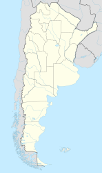
| Location of Rafaela in Argentina | ||
| Coordinates: 31°16′S 61°29′W / 31.267°S 61.483°WCoordinates: 31°16′S 61°29′W / 31.267°S 61.483°W | ||
| Country | Argentina | |
| Province | Santa Fe | |
| Department | Castellanos | |
| Founded by | Guillermo Lehmann (colonist) | |
| Government | ||
| • Mayor | Luis Castellano (Justicialist) | |
| Area | ||
| • Total | 156 km2 (60 sq mi) | |
| Elevation | 90 m (300 ft) | |
| Population (2012) | ||
| • Total | 103,699 | |
| • Density | 660/km2 (1,700/sq mi) | |
| Demonym(s) | rafaelino | |
| Time zone | ART (UTC-3) | |
| CPA base | S2300 | |
| Dialing code | +54 3492 | |
| Website | Official website | |
Rafaela (Spanish pronunciation: [rafaˈela]) is a city in the province of Santa Fe, Argentina, about 96 km from the provincial capital. It is the head town of the Castellanos Department. It has a population of 99,150 per the 2010 census [INDEC].
The town was established in 1881 by Guillermo Lehmann, and officially became a city in 1913. The city has grown 22.2% between 1991 and 2001, and 18.6% in the last census period (2001-2011) according to the official data of the Population Census (INDEC). The city is almost the exact antipode of Wuhu in China.
The city is located in the western-center area of Santa Fe Province and has an area of 156 km2 (60.2 sq mi). The design of most of the urban area of the city has a shape of a checkerboard with the main plaza (Plaza 25 de mayo) in the middle of the city and four main boulevards coming from there. The street grid of the city is composed by square blocks in most part of the neighborhoods, mainly in the historical and older part of the city.
The city has 37 neighborhoods and the downtown area (called Microcentro in Spanish) as the map of the city shows.
In 2008 the government approved the Urban Code of Rafaela, and since that the planning of the city became more organized and institutionalized. The Urban Code of Rafaela is the regulation that manages and controls the development of the city. One of the main changes was the transition from a zoning approach, that was based on the classification of the land use, to an approach that evaluates the levels of complexity and impact of the economic activities in the city and the environment.
The Urban Code was declared by the Ordinance N 4170, in May 2008 but it is a tool that is revised and updated once a year. The Municipal Executive Government of Rafaela is the institution with the capability to regulate the zoning and the economic activities that are allow in each zone. In order to do that, the Executive and the departments involved has elaborated an evaluation system and a classification of the activities. The Urban Code is applied in the entire District of Rafaela.
...
Wikipedia


