Radika
| Radika (Радика) | |
|---|---|

Radika River
|
|
| Country | Kosovo,Macedonia |
| Physical characteristics | |
| Main source | Mount Vraca, Kosovo |
| River mouth |
Black Drin river, south of Debar, Macedonia 41°29′38″N 20°30′54″E / 41.494°N 20.515°ECoordinates: 41°29′38″N 20°30′54″E / 41.494°N 20.515°E |
| Length | 70 km (43 mi) |
| Basin features | |
| Basin size | 665 km2 (257 sq mi) |
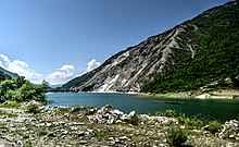
The Radika (Macedonian and Serbian: ![]() Радика , Radika; Albanian: Radika) is a river in southern Kosovo and western Macedonia, a 70 km (43 mi)-long right tributary to the Black Drin river.
Радика , Radika; Albanian: Radika) is a river in southern Kosovo and western Macedonia, a 70 km (43 mi)-long right tributary to the Black Drin river.
The Radika proper is 52 km (32 mi) long, but measured from the most distant source in its watershed, that of the Crni Kamen river, it is 70 km (43 mi) long.
The Crni Kamen (Cyrillic: Црни Камен; "black stone"; Albanian 'Guri i zi') springs out from the northern slopes of the Vraca mountain, the southern extension of the Šar Mountains, under the Golema Vraca peak (2,582 m or 8,471 ft). The 'Guri i Zi' 'Crni Kamen' originally flows westward, through the Gora region, bends around the Vraca and sharply turns to the south and empties into the Kosovo-Macedonian border river Qafa e Kadies Ćafa Kadis (Serbian Cyrillic: Ћафа Кадис; Macedonian: Ќафа Кадис;).
The Ćafa Kadis originates from the southern slopes of the Vraca mountain and northern slopes of the Mangulova Kula mountain, another extension of the Šar Mountains. It flows westwards, on the northern section of the mountain of Ničipurska planina (Brodec peak, still part of the Šar massif) and for several kilometers forms the Kosovo-Macedonian border. After it receives the Crni Kamen from the right and another stream coming from Kosovo, the Ćafa Kadis turns south into the Macedonian proper again and from this point it is known as the Radika.
...
Wikipedia
