Rütschelen
| Rütschelen | ||
|---|---|---|
|
||
| Coordinates: 47°10′N 7°47′E / 47.167°N 7.783°ECoordinates: 47°10′N 7°47′E / 47.167°N 7.783°E | ||
| Country | Switzerland | |
| Canton | Bern | |
| District | Oberaargau | |
| Area | ||
| • Total | 3.98 km2 (1.54 sq mi) | |
| Elevation | 545 m (1,788 ft) | |
| Population (Dec 2015) | ||
| • Total | 571 | |
| • Density | 140/km2 (370/sq mi) | |
| Postal code | 4933 | |
| SFOS number | 0340 | |
| Surrounded by | Bleienbach, Leimiswil, Lotzwil, Madiswil, Ochlenberg | |
| Website |
www SFSO statistics |
|
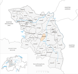
Rütschelen is a municipality in the Oberaargau administrative district in the canton of Bern in Switzerland.
Rütschelen is first mentioned in 1273 as Ruschole.
Rütschelen ruled by the Counts of Kyburg, though St. Urban's Abbey and the Thunstetten Commandery were also important landholders. In 1385, the low court was pledged to the Rohrmoos and Mattstetten families, former Kyburg Ministerialis (unfree knights in the service of a feudal overlord) families. However, in the following decades they were forced, in turn, to pledge the low court to the town of Burgdorf in 1394 and 1402. In 1400 Burgdorf acquired some neighboring land from Goetz von Hünenberg and later combined both into a single part of the bailiwick of Lotzwil.
Around 1600, the village divided up the common land to make private land. Then, in 1616, a shared grazing agreement between Bleienbach and Wil was abolished. This loss of common grazing land hurt many farmers economically and throughout the 17th and 18th centuries they fought among themselves and against the village council for the use of the remaining common land. Starting in the 18th century, cottage industries such as linen weaving and stocking knitting began to supplement the local economy. After 1850, agriculture became increasingly mechanized and required fewer farm workers. The resulting lack of jobs forced many residents to migrate to the cities. Agriculture remains very important and in 2005, over half of all jobs in Rütschelen were in that sector.
Rütschelen has an area of 3.98 km2 (1.54 sq mi). Of this area, 2.24 km2 (0.86 sq mi) or 56.3% is used for agricultural purposes, while 1.47 km2 (0.57 sq mi) or 36.9% is forested. Of the rest of the land, 0.28 km2 (0.11 sq mi) or 7.0% is settled (buildings or roads).
...
Wikipedia


