Rüppurr
|
Karlsruhe Carlsruhe |
|||
|---|---|---|---|

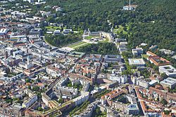
View over Karlsruhe
|
|||
|
|||
| Coordinates: 49°00′33″N 8°24′14″E / 49.00920970°N 8.40395140°ECoordinates: 49°00′33″N 8°24′14″E / 49.00920970°N 8.40395140°E | |||
| Country | Germany | ||
| State | Baden-Württemberg | ||
| Admin. region | Karlsruhe | ||
| District | Urban district | ||
| Founded | 1715 | ||
| Government | |||
| • Lord Mayor | Frank Mentrup (SPD) | ||
| Area | |||
| • Total | 173.46 km2 (66.97 sq mi) | ||
| Elevation | 115 m (377 ft) | ||
| Population (2015-12-31) | |||
| • Total | 307,755 | ||
| • Density | 1,800/km2 (4,600/sq mi) | ||
| Time zone | CET/CEST (UTC+1/+2) | ||
| Postal codes | 76131–76229 | ||
| Dialling codes | 0721 | ||
| Vehicle registration | KA | ||
| Website | www.karlsruhe.de | ||
Karlsruhe (German pronunciation: [ˈkaɐ̯lsˌʁuːə]; formerly Carlsruhe) is the second-largest city in the state of Baden-Württemberg, in southwest Germany, near the French-German border. It has a population of 307,755. The city is the seat of the two highest courts in Germany: the Federal Constitutional Court and the Federal Court of Justice. Its most remarkable building is Karlsruhe Palace, which was built in 1715.
Karlsruhe lies completely to the right of the Rhine, and almost completely on the Upper Rhine Plain. It contains the Turmberg in the east, and also lies on the borders of the Kraichgau leading to the Northern Black Forest.
The Rhine, one of the world's most important shipping routes forms the western limits of the city, beyond which lie the towns of Maximiliansau and Wörth am Rhein in the German state of Rhineland-Palatinate. The city centre is approximately 7.5 km (4.7 mi) from the river, as measured from the Marktplatz (Market Square). The two tributaries of the Rhine, the Alb and the Pfinz flow through the city from the Kraichgau to eventually join the Rhine.
The city lies at an altitude between 100 m and 322 m (near the communications tower In the suburb of Grünwettersbach). Its geographical coordinates are 49°00′N 8°24′E / 49.000°N 8.400°E; the 49th parallel runs through the city centre, which puts it at the same latitude as much of the Canada-United States border, the cities Vancouver (Canada), Paris (France), Regensburg (Germany) and Hulunbuir (China). Its course is marked by a stone and painted line in the Stadtgarten (municipal park). The total area of the city is 173.46 km2 (66.97 sq mi), and hence is the 30th largest city in Germany measured by land area. The longest North-South distance is 16.8 km (10.4 mi) and 19.3 km (12.0 mi) in the East-West direction.
...
Wikipedia


