Quincy, Washington
| Quincy, Washington | |
|---|---|
| City | |

House in Crescent Bar resort, near Quincy
|
|
| Motto: Where Agriculture Meets Technology Motto: Opportunities Unlimited |
|
 Location of Quincy, Washington |
|
| Coordinates: 47°14′1″N 119°51′8″W / 47.23361°N 119.85222°WCoordinates: 47°14′1″N 119°51′8″W / 47.23361°N 119.85222°W | |
| Country | United States |
| State | Washington |
| County | Grant |
| Government | |
| • Mayor | Jim Hemberry |
| • Chief of Police | Bob Heimbach |
| Area | |
| • Total | 5.04 sq mi (13.05 km2) |
| • Land | 4.96 sq mi (12.85 km2) |
| • Water | 0.08 sq mi (0.21 km2) |
| Elevation | 1,302 ft (397 m) |
| Population (2010) | |
| • Total | 6,750 |
| • Estimate (2015) | 7,365 |
| • Density | 1,360.9/sq mi (525.4/km2) |
| Time zone | Pacific (PST) (UTC-8) |
| • Summer (DST) | PDT (UTC-7) |
| ZIP code | 98848 |
| Area code(s) | 509 |
| FIPS code | 53-57115 |
| GNIS feature ID | 1512590 |
| Website | City of Quincy |
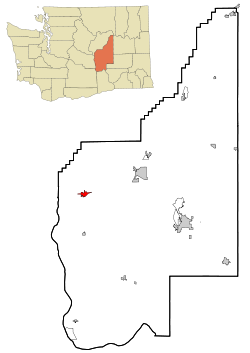
Quincy is a city in Grant County, Washington, United States. The population was 6,750 at the 2010 census.
The Missoula Floods had their outlet at Trinidad, close to Quincy. Glacial erratics carried from as far away as Montana can be found nearby. The area also has an abundance of rimrock.
Quincy was founded as a railroad camp during construction of the Great Northern Railway in 1892, and was incorporated on March 27, 1907. It was named after Quincy, Illinois.
The arrival of the water from the Grand Coulee Dam in 1952 changed the town.
Quincy is located at 47°14′1″N 119°51′8″W / 47.23361°N 119.85222°W (47.233691, -119.852296).
According to the United States Census Bureau, the city has a total area of 5.04 square miles (13.05 km2), of which, 4.96 square miles (12.85 km2) is land and 0.08 square miles (0.21 km2) is water.
Quincy has a cold semi-arid climate (BSk) according to the Köppen climate classification system.
As of the census of 2010, there were 6,750 people, 1,915 households, and 1,541 families residing in the city. The population density was 1,360.9 inhabitants per square mile (525.4/km2). There were 2,020 housing units at an average density of 407.3 per square mile (157.3/km2). The racial makeup of the city was 54.9% White, 0.4% African American, 0.9% Native American, 0.7% Asian, 0.2% Pacific Islander, 40.6% from other races, and 2.4% from two or more races. Hispanic or Latino of any race were 74.3% of the population.
...
Wikipedia
