Quba Rayon
|
Quba Lezgian: Къуба район |
|
|---|---|
| Rayon | |
| Azerbaijani: Quba rayonu | |

|
|
 Map of Azerbaijan showing Quba Rayon |
|
| Coordinates: 41°22′12″N 48°30′00″E / 41.37000°N 48.50000°ECoordinates: 41°22′12″N 48°30′00″E / 41.37000°N 48.50000°E | |
| Country |
|
| Capital | Quba |
| Area | |
| • Total | 2,574 km2 (994 sq mi) |
| Population (2014) | |
| • Total | 161,434 |
| • Density | 63/km2 (160/sq mi) |
| Time zone | AZT (UTC+4) |
| • Summer (DST) | AZT (UTC+5) |
| Postal code | 4000 |
| Telephone code | (+994) 23 |
| Website | www |
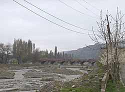
Quba (Azerbaijani: Quba rayonu, Lezgian: Къуба район) is a rayon in northeastern Azerbaijan. The capital, Quba, is located on the Qudyal River at 41.37°N, 48.50°E.
The fertile region surrounding Quba is best known for its production of apples and the city area of Quba is known for its fine carpets.
Azerbaijanis (All parts of district) - 71%, Tats (Southern parts) - 18% and Lezgians (Northwestern parts) - 9% are the largest ethnic groups of Quba District. Khinalugs (1%) are living in the village of Khinalug.
Ismailly, Shamakhi, Gabala, Qusar, Khachmaz, Devechi, Khizi
Quba rose to prominence in the 18th century. In 1747, Nader Shah ruler of the Persian Empire was assassinated. That same year, Hussein-Ali, the Shah's designated ruler of the region, decided to attempt to unify the Azeri khanates as an independent kingdom. One of his first moves was moving his capital from the less defensible Xudat in the Caspian lowlands to Quba where he built a fortress. Hussein-Ali died in 1757 and his son Fatali Khan carried on the expansion with Quba reaping the riches of its status as the capital. Some ruins from this period, such as Çirax Qala on the way to Baku, exist today.
...
Wikipedia
