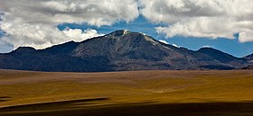
Putana Volcano
| Putana | |
|---|---|

The Putana volcano seen from the west.
|
|
| Highest point | |
| Elevation | 5,890 m (19,320 ft) |
| Coordinates | 22°33′S 67°51′W / 22.550°S 67.850°WCoordinates: 22°33′S 67°51′W / 22.550°S 67.850°W |
| Geography | |
| Location | Bolivia-Chile |
| Parent range | Andes |
| Geology | |
| Mountain type | Stratovolcano |
| Last eruption | 1810 ± 10 years |
Putana (also known as Jorqencal or Machuca) is a stratovolcano on the border between Bolivia and Chile. It lies immediately NNE of Cerro Colorado, about 6 km (4 mi) north of Volcán Escalante, the northernmost member of the Sairecabur complex and 14 km (9 mi) south of the complex. Intense fumarolic activity occurs at its summit, and a solfatara (see fumarole) can be observed in the main crater.
...
Wikipedia
