Pulawy
| Puławy | |||
|---|---|---|---|

Czartoryski Palace.
|
|||
|
|||
| Coordinates: 51°25′N 21°58′E / 51.417°N 21.967°E | |||
| Country |
|
||
| Voivodeship | Lublin | ||
| County | Puławy County | ||
| Gmina | Puławy (urban gmina) | ||
| Established | 16th century | ||
| Town rights | 1906 | ||
| Government | |||
| • Mayor | Janusz Grobel | ||
| Area | |||
| • Total | 50.49 km2 (19.49 sq mi) | ||
| Elevation | 115 m (377 ft) | ||
| Population (2006) | |||
| • Total | 49,839 | ||
| • Density | 990/km2 (2,600/sq mi) | ||
| Postal code | 24-100 to 24-112 | ||
| Area code(s) | +48 081 | ||
| Car plates | LPU | ||
| Website | http://www.um.pulawy.pl | ||
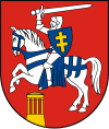
Puławy pronounced [puˈwavɨ] is a city in eastern Poland, in Lublin Province of northern Lesser Poland, located at the confluence of the Wisła and Kurówka rivers. According to the GUS census estimate, the city had a total population of 49,839 in 2006. Puławy is the capital of Puławy County, and was known as Nowa Aleksandria, or Nowo Aleksandria, from 1846 to 1918 during partitions of Poland. Its coat of arms is the Pahonia.
Puławy was first mentioned in documents in the 15th century. At that time, it was spelled as Pollavy, and its name probably comes from a Vistula river ford, which was located nearby. The town is a local center of science, industry and tourism, together with nearby Nałęczów and Kazimierz Dolny. Puławy is home to Poland’s first permanent museum, it also is a Vistula river port. The town has two bridges, four rail stations, and serves as a road junction. In the nearby Dęblin there is an airport. Puławy has several sports clubs, with the most famous ones being Wisła Pulawy (men’s football 2nd Eastern Division in 2012/13, swimming, track and field, weight lifting), and Azoty Puławy (men’s handball 1st Division).
Puławy lies in western part of the Lublin province, at the edge of the picturesque Lesser Polish Gorge of the Vistula, and near the easternmost point of the Vistula river. Historically the town belongs to Lesser Poland, and geographically, it lies at the border of Mazovian Lowland and Lublin Upland. The area of the town is 50.49 square kilometres (19.49 sq mi). Puławy is located on National Road Nr. 12, which goes West - East, from Łęknica at the German border, to Dorohusk at the Ukrainian border. Furthermore, the town has four rail stations (Puławy, Puławy Azoty, Puławy Chemia and Puławy Miasto). Long distance rail transport is served by the Puławy Miasto station, with connections to all Polish cities.
...
Wikipedia


