Pu'er Hani and Yi Autonomous County
|
Ning'er County 宁洱哈尼族彝族自治县 |
|
|---|---|
| Autonomous county | |
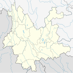
 Location of Ning'er County (pink) and Pu'er Prefecture (yellow) within Yunnan province of China |
|
| Location within Yunnan, China | |
| Coordinates: 23°05′N 101°03′E / 23.083°N 101.050°E | |
| Country | China |
| Province | Yunnan |
| Prefecture | Pu'er |
| 530821 | |
| Area | |
| • Total | 3,670 km2 (1,420 sq mi) |
| Population | |
| • Total | 184,235 |
| • Density | 50/km2 (130/sq mi) |
| Time zone | China Standard Time (UTC+8) |
| Postal code | 665100 |
| Area code(s) | 0879 |
| Website | Ning-er Information Network |
|
1Yunnan Statistics Bureau [1] 2Puer Gov. [2] 3Yunnan Portal [3] |
|
The Ning'er Hani and Yi Autonomous County (simplified Chinese: 宁洱哈尼族彝族自治县; traditional Chinese: 寧洱哈尼族彝族自治縣; pinyin: Níng'ěr Hānízú Yízú Zìzhìxiàn) is an autonomous county under the jurisdiction of Pu'er Prefecture, Yunnan Province, China.
The population of the county has a large proportion of native Hani and Yi people in a predominately Han Chinese population. As of 2003 the county records a population of approximately 190,000 people.
Ethnic Bai (population: 5,139) are found in Kesa 克洒, Heping village 和平村, Mengxian township 勐先乡 (Pu'er County Almanac 1993:120).
The Datou 达头 people number 254 persons and are found in Ning'er County and Simao City. They consider themselves to be ethnic Yi, and also speak a Yi language (You 2013:133).
This county gives its name to Pu-erh tea, due to its historical role in the tea trade in Ancient China.
Coordinates: 23°05′N 101°03′E / 23.083°N 101.050°E
...
Wikipedia

