Providenciales International Airport
| Providenciales International Airport |
|||||||||||
|---|---|---|---|---|---|---|---|---|---|---|---|
 |
|||||||||||
| Summary | |||||||||||
| Operator | Providenciales Airport Company | ||||||||||
| Location | Providenciales, Turks and Caicos Islands | ||||||||||
| Hub for | InterCaribbean Airways | ||||||||||
| Elevation AMSL | 15 ft / 5 m | ||||||||||
| Coordinates | 21°46′25″N 72°15′57″W / 21.77361°N 72.26583°WCoordinates: 21°46′25″N 72°15′57″W / 21.77361°N 72.26583°W | ||||||||||
| Website | provoairport.com | ||||||||||
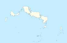
| Map | |||||||||||
| Location in Providenciales | |||||||||||
| Runways | |||||||||||
|
|||||||||||
|
Source: DAFIF
|
|||||||||||
Providenciales International Airport (IATA: PLS, ICAO: MBPV), on the island of Providenciales in the Caicos Islands, is the main international airport serving the Turks and Caicos Islands, a British Overseas Territory of the United Kingdom. It is operated by Turks and Caicos Islands Airports Authority (TCIAA). The territory's other international airport is JAGS McCartney International Airport on Grand Turk Island. Currently, there are more than 12,000 commercial aircraft operations per year.
The airport resides at an elevation of 15 ft (5 m) above mean sea level. It has one runway designated 10/28 with an asphalt surface measuring 2,807 m × 45 m (9,209 ft × 148 ft). There were plans for the TCIAA to either extend or build a new terminal after having recently completed the extension of the runway, which currently stands at 2,807 m (9,209 ft) long. These plans have been enacted and the renovation was finished by December 2014.
...
Wikipedia

