JAGS McCartney International Airport
| JAGS McCartney International Airport | |||||||||||
|---|---|---|---|---|---|---|---|---|---|---|---|
 |
|||||||||||
| Summary | |||||||||||
| Airport type | Public | ||||||||||
| Operator | Civil Aviation Department | ||||||||||
| Location | Grand Turk Island | ||||||||||
| Elevation AMSL | 13 ft / 4 m | ||||||||||
| Coordinates | 21°26′40″N 071°08′32″W / 21.44444°N 71.14222°WCoordinates: 21°26′40″N 071°08′32″W / 21.44444°N 71.14222°W | ||||||||||
| Website | https://www.visittci.com/grand-turk-jags-mccartney-international-airport-gdt | ||||||||||
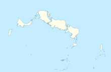
| Map | |||||||||||
| Location in Grand Turk Island | |||||||||||
| Runways | |||||||||||
|
|||||||||||
|
Source: DAFIF
|
|||||||||||
JAGS McCartney International Airport (IATA: GDT, ICAO: MBGT), also known as Grand Turk International Airport, is an airport located one mile south of Cockburn Town on Grand Turk Island in the Turks and Caicos Islands, an overseas territory of the United Kingdom. It is the second largest airport in the Turks & Caicos, after Providenciales International Airport.
The airport is named for James Alexander George Smith McCartney, the Territory's first Chief Minister, who died in a plane crash in New Jersey, United States in 1980.
JAGS McCartney has the ability to handle large aircraft, such as the Boeing 757 and Airbus A321 jets. The airport also houses a restaurant, rental car facilities, and free parking facilities. There is no public transportation on the island. The majority of the aerial services originating out of the airport are domestic flights within the Turks and Caicos Islands. However, international and other charter flights are popular during the peak travel season.
...
Wikipedia

