Prince Albert (Glass Field) Airport
| Prince Albert (Glass Field) Airport | |||||||||||||||
|---|---|---|---|---|---|---|---|---|---|---|---|---|---|---|---|
 |
|||||||||||||||
| Summary | |||||||||||||||
| Airport type | Public | ||||||||||||||
| Operator | City of Prince Albert | ||||||||||||||
| Serves | Prince Albert | ||||||||||||||
| Location | Prince Albert, Saskatchewan | ||||||||||||||
| Hub for | |||||||||||||||
| Time zone | CST (UTC−06:00) | ||||||||||||||
| Elevation AMSL | 1,405 ft / 428 m | ||||||||||||||
| Coordinates | 53°12′52″N 105°40′23″W / 53.21444°N 105.67306°WCoordinates: 53°12′52″N 105°40′23″W / 53.21444°N 105.67306°W | ||||||||||||||
| Website | www.princealbertairport.com | ||||||||||||||
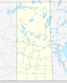
| Map | |||||||||||||||
| Location in Saskatchewan | |||||||||||||||
| Runways | |||||||||||||||
|
|||||||||||||||
| Statistics (2010) | |||||||||||||||
|
|||||||||||||||
| Aircraft movements | 20,119 |
|---|
Prince Albert (Glass Field) Airport (IATA: YPA, ICAO: CYPA) is located 1 nautical mile (1.9 km; 1.2 mi) northeast of Prince Albert, Saskatchewan, Canada.
The airport was originally opened near Prince Albert on 22 July 1940 under the British Commonwealth Air Training Plan as No. 6 Elementary Flying Training School, with Relief Landing Fields located near Hagen and Emma Lake. The school closed on 15 November 1944.
From 17 March 1941 to 11 November 1942, the station doubled as No. 6 Air Observer School.
All that remains of the former No. 6 EFTS are two World War II era hangars. A monument was erected to pay tribute to the 17 airmen and one civilian who died in training accidents at the school.
This airport is now named for Floyd Glass, who learned to fly in the late 1930s, then served as a military flying training instructor during the Second World War. Postwar, he was the first general manager of the provincial Crown corporation Saskatchewan Government Airways. He resigned from this post, flew briefly with British Columbia's Queen Charlotte Airways, then returned to Saskatchewan and in 1955 formed his own firm, Athabaska Airways, which still exists under the name "Transwest Air". Glass died in 2000.
...
Wikipedia


