Presidente Figueiredo
| Presidente Figueiredo | ||
|---|---|---|
 |
||
|
||
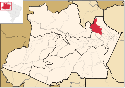
 Location of the municipality inside Amazonas |
||
| Coordinates: 2°1′2″S 60°1′30″W / 2.01722°S 60.02500°WCoordinates: 2°1′2″S 60°1′30″W / 2.01722°S 60.02500°W | ||
| Country |
|
|
| Region | North | |
| State |
|
|
| Time zone | BRT (UTC−4) | |
| • Summer (DST) | DST no longer used (UTC−4) | |
Presidente Figueiredo is a municipality located in the Brazilian state of Amazonas. Its population was 30,978 (2013) and its area is 25,422 km².
The municipality contains the 374,700 hectares (926,000 acres) Caverna do Maroaga Environmental Protection Area, established in 1990. It contains part of the 938,720 hectares (2,319,600 acres) Uatumã Biological Reserve, a strictly protected conservation unit created in 2002. It also holds about 2% of the Rio Negro Left Bank Environmental Protection Area, a 611,008 hectares (1,509,830 acres) sustainable use conservation area created in 1995.
...
Wikipedia

