Powers, Oregon
| Powers, Oregon | |
|---|---|
| City | |

Powers, Oregon skyline
|
|
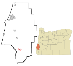
 Location in Oregon |
|
| Coordinates: 42°53′0″N 124°4′23″W / 42.88333°N 124.07306°WCoordinates: 42°53′0″N 124°4′23″W / 42.88333°N 124.07306°W | |
| Country | United States |
| State | Oregon |
| County | Coos |
| Incorporated | 1945 |
| Government | |
| • Mayor | Bill Holland |
| Area | |
| • Total | 0.64 sq mi (1.66 km2) |
| • Land | 0.59 sq mi (1.53 km2) |
| • Water | 0.05 sq mi (0.13 km2) |
| Elevation | 286 ft (87 m) |
| Population (2010) | |
| • Total | 689 |
| • Estimate (2012) | 683 |
| • Density | 1,167.8/sq mi (450.9/km2) |
| Time zone | Pacific (UTC-8) |
| • Summer (DST) | Pacific (UTC-7) |
| ZIP code | 97466 |
| Area code(s) | 541 |
| FIPS code | 41-59600 |
| GNIS feature ID | 1147970 |
Powers is a city in Coos County, Oregon, United States. The population was 689 at the 2010 census.
Powers is 21 miles (34 km) south of Oregon Route 42 at Myrtle Point on Oregon Route 542 (Powers Highway) along the South Fork Coquille River. Forest roads connect Powers to the Rogue River, 35 miles (56 km) further south. The Glendale–Powers Bike Trail passes through Powers.
According to the United States Census Bureau, the city has a total area of 0.64 square miles (1.66 km2), of which 0.59 square miles (1.53 km2) is land and 0.05 square miles (0.13 km2) is water.
Powers has cool, very wet winters and warm, mostly dry summers.
The influence of the Pacific Ocean moderates the climate, especially in the summer when the temperature regularly drops into the upper forties to lower fifties at night. The coolest month, January, has an average maximum temperature of about 53 °F (12 °C) and an average minimum of about 35 °F (2 °C). August is the warmest month with an average maximum of about 79 °F (26 °C) and an average minimum of about 51 °F (11 °C). The highest temperature recorded was 104 °F (40 °C) on August 8, 1978, and the lowest temperature was 5 °F (−15 °C) on December 31, 1990. Annually, there are 6.5 days with highs of 90 °F (32 °C) or higher and 45.1 days with lows of 32 °F (0 °C) or lower.
Average annual rainfall is 60.74 inches (1,543 mm) and there are an average of 138 days with measurable precipitation. The wettest year was 1996 with 95.35 inches (2,422 mm) and the driest year was 1976 with 31.69 inches (805 mm). The most rainfall in one month was 26.99 inches (686 mm) in November 1973. The greatest 24-hour rainfall was 6.25 inches (159 mm) on November 19, 1996.
While snow is common during the winter on the mountains surrounding Powers, the city itself averages only 2.5 inches (6.4 cm) of snow each year. The snowiest year was 1950 when 18.4 inches (47 cm) fell, including 18.0 inches (46 cm) in January. The most snow in 24 hours was 8.0 inches (20 cm), recorded on February 2, 1989, and again on February 3, 1989.
...
Wikipedia
