Potter, Nebraska
| Potter, Nebraska | |
|---|---|
| Village | |

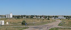
Potter seen from Exit 38 on Interstate 80
|
|
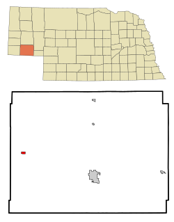
 Location of Potter, Nebraska |
|
| Coordinates: 41°13′4″N 103°18′53″W / 41.21778°N 103.31472°WCoordinates: 41°13′4″N 103°18′53″W / 41.21778°N 103.31472°W | |
| Country | United States |
| State | Nebraska |
| County | Cheyenne |
| Area | |
| • Total | 0.46 sq mi (1.19 km2) |
| • Land | 0.46 sq mi (1.19 km2) |
| • Water | 0 sq mi (0 km2) |
| Elevation | 4,400 ft (1,341 m) |
| Population (2010) | |
| • Total | 337 |
| • Estimate (2016) | 326 |
| • Density | 730/sq mi (280/km2) |
| Time zone | Mountain (MST) (UTC-7) |
| • Summer (DST) | MDT (UTC-6) |
| ZIP code | 69156 |
| Area code(s) | 308 |
| FIPS code | 31-39870 |
| GNIS feature ID | 0832328 |
Potter is a village in Cheyenne County, Nebraska, in the United States. As of the 2010 census, the village population was 337.
Potter had its start in the year 1870 by the building of the railroad through that territory. It was named for General Potter, a railroad shareholder.
On July 6, 1928, Potter received the largest hailstone ever recorded, which measured approximately 7 inches (17.8 centimeters) in diameter and weighed approximately 1.5 pounds (680 grams). Another hailstone of that diameter measurement was recovered in Aurora, Nebraska, on June 22, 2003.
Potter is located at 41°13′4″N 103°18′53″W / 41.21778°N 103.31472°W (41.217830, -103.314788).
According to the United States Census Bureau, the village has a total area of 0.46 square miles (1.19 km2), all of it land.
As of the census of 2010, there were 337 people, 151 households, and 101 families residing in the village. The population density was 732.6 inhabitants per square mile (282.9/km2). There were 175 housing units at an average density of 380.4 per square mile (146.9/km2). The racial makeup of the village was 96.1% White, 1.2% Native American, and 2.7% from other races. Hispanic or Latino of any race were 4.5% of the population.
...
Wikipedia
