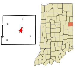
Portland, Indiana
| Portland, Indiana | |
|---|---|
| City | |
 Location in the state of Indiana |
|
| Coordinates: 40°26′2″N 84°58′48″W / 40.43389°N 84.98000°WCoordinates: 40°26′2″N 84°58′48″W / 40.43389°N 84.98000°W | |
| Country | United States |
| State | Indiana |
| County | Jay |
| Government | |
| • Mayor | Randy Geesaman (D) |
| Area | |
| • Total | 4.1 sq mi (10.6 km2) |
| • Land | 4.1 sq mi (10.6 km2) |
| • Water | 0 sq mi (0 km2) 0.24%% |
| Elevation | 909 ft (277 m) |
| Population (2015) | |
| • Total | 6,186 |
| • Estimate (2015) | 6,186 |
| • Density | 1,508.78/sq mi (583.6/km2) |
| Time zone | EST (UTC-5) |
| • Summer (DST) | EDT (UTC-4) |
| ZIP code | 47371 |
| Area code(s) | 260 |
| FIPS code | 18-61236 |
| GNIS feature ID | 0441471 |
| Website | http://www.thecityofportland.net |
Portland is a city in and the county seat of Jay County, Indiana, United States. The population was 6,186 at the 2015 census.
Portland was platted in 1837. It was named after Portland, Maine.
The Jay County Courthouse, Portland Commercial Historic District, and Jonas Votaw House are listed on the National Register of Historic Places.
Portland is located at 40°26′2″N 84°58′48″W / 40.43389°N 84.98000°W (40.433884, -84.979914), along the Salamonie River.
According to the 2015 census, Portland has a total area of 4.1 square miles (10.62 km2), of which 4.1 square miles (10.62 km2) (or 99.76%) is land and 0.984 square miles (2.55 km2) (or 0.24%) is water.
As of the census of 2015, there were 6,186 people, 2,607 households, and 1,620 families residing in the city. The population density was 1,508.8 inhabitants per square mile (582.6/km2). There were 2,928 housing units at an average density of 712.7 per square mile (275.2/km2). The racial makeup of the city was 96.49% White, 0.37% African American, 0.11% Native American, 0.34% Asian, 0.05% Pacific Islander, 1.8% from other races, and 0.84% from two or more races. Hispanic or Latino of any race were 3.36% of the population.
...
Wikipedia
