Portage, Ohio
| Portage, Ohio | |
|---|---|
| Village | |

Portage, Ohio is bisected by State Route 25, sometimes known as South Dixie Highway.
|
|
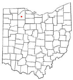
 Location of Portage, Ohio |
|
 Location of Portage in Wood County |
|
| Coordinates: 41°19′34″N 83°38′59″W / 41.32611°N 83.64972°WCoordinates: 41°19′34″N 83°38′59″W / 41.32611°N 83.64972°W | |
| Country | United States |
| State | Ohio |
| County | Wood |
| Government | |
| • Mayor | William Mark Wolford |
| Area | |
| • Total | 1.49 sq mi (3.86 km2) |
| • Land | 1.49 sq mi (3.86 km2) |
| • Water | 0 sq mi (0 km2) |
| Elevation | 686 ft (209 m) |
| Population (2010) | |
| • Total | 438 |
| • Estimate (2012) | 442 |
| • Density | 294.0/sq mi (113.5/km2) |
| Time zone | Eastern (EST) (UTC-5) |
| • Summer (DST) | EDT (UTC-4) |
| ZIP code | 43451 |
| Area code(s) | 419 |
| FIPS code | 39-64108 |
| GNIS feature ID | 1061566 |
Portage is a village in Wood County, Ohio, United States. The population was 438 at the 2010 census.
Portage was platted in 1836. The village takes its name from the nearby Portage River. A post office called Portage has been in operation since 1829. Portage was incorporated as a village in 1857.
Portage is located at 41°19′34″N 83°38′59″W / 41.32611°N 83.64972°W (41.326157, -83.649646).
According to the United States Census Bureau, the village has a total area of 1.49 square miles (3.86 km2), all land.
As of the census of 2010, there were 438 people, 164 households, and 105 families residing in the village. The population density was 294.0 inhabitants per square mile (113.5/km2). There were 174 housing units at an average density of 116.8 per square mile (45.1/km2). The racial makeup of the village was 94.1% White, 1.4% African American, 0.5% Native American, 0.5% Pacific Islander, 3.0% from other races, and 0.7% from two or more races. Hispanic or Latino of any race were 7.8% of the population.
...
Wikipedia
