Port Augusta West, South Australia
|
Port Augusta West Port Augusta, South Australia |
|||||||||||||||
|---|---|---|---|---|---|---|---|---|---|---|---|---|---|---|---|

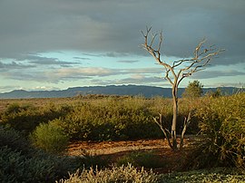
Australian Arid Lands Botanic Garden
|
|||||||||||||||
| Coordinates | 32°29′03″S 137°45′32″E / 32.4842°S 137.7589°ECoordinates: 32°29′03″S 137°45′32″E / 32.4842°S 137.7589°E | ||||||||||||||
| Population | 4,153 (2011 census) | ||||||||||||||
| Established | 1865 | ||||||||||||||
| Postcode(s) | 5700 | ||||||||||||||
| Elevation | 14 m (46 ft) | ||||||||||||||
| Location |
|
||||||||||||||
| LGA(s) | Port Augusta City Council | ||||||||||||||
| State electorate(s) | Stuart | ||||||||||||||
| Federal Division(s) | Grey | ||||||||||||||
|
|||||||||||||||
|
|||||||||||||||
| Footnotes | Coordinates Climatic data Location |
||||||||||||||
Port Augusta West is a suburb of Port Augusta, South Australia.
However, it has a separate early colonial history to Port Augusta, because it is on the Eyre Peninsula, while the rest of Port Augusta is on the east side of Spencer Gulf. It was not until 1926 that a bridge was built across the head of the Spencer Gulf to connect them, replacing a punt.
The Corporate Town of Port Augusta West was gazetted on 6 October 1887, and only merged into the Corporate Town of Port Augusta on 28 April 1932.
Port Augusta West contains the junction of the Eyre Highway (to Eyre Peninsula and Western Australia), Stuart Highway (to the Far North and Northern Territory), and Augusta Highway (to Adelaide).
Port Augusta West is the only part of Port Augusta that is located on the western side of Spencer Gulf on the Eyre Peninsula. It is about 2 kilometres (1.2 miles) west of the centre of Port Augusta and about 280 kilometres (170 miles) north of Adelaide city centre.
Port Augusta West consists of an urban area on the east coast of the Eyre Peninsula, immediately west of the centre of Port Augusta. It is dissected by the Augusta Highway, which branches in the middle of the suburb, to become the Stuart Highway which heads north, and the Eyre Highway which heads south. The Whyalla-Port Augusta railway line passes to the north and west of the suburb’s urban area.
...
Wikipedia

