Pontardawe
| Pontardawe | |
|---|---|
 View northward over Pontardawe |
|
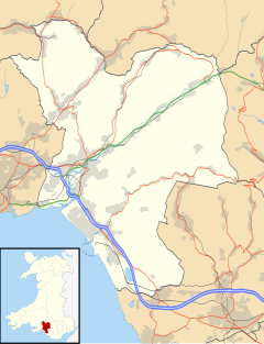
| Pontardawe shown within Neath Port Talbot | |
| Population | 6,832 (2011 census) |
| OS grid reference | SN721040 |
| Principal area | |
| Ceremonial county | |
| Country | Wales |
| Sovereign state | United Kingdom |
| Post town | SWANSEA |
| Postcode district | SA8-SA9 |
| Dialling code | 01792 |
| Police | South Wales |
| Fire | Mid and West Wales |
| Ambulance | Welsh |
| EU Parliament | Wales |
| UK Parliament | |
| Welsh Assembly | |
Pontardawe (Welsh pronunciation: [pɔntarˈdawɛ] – "bridge on the Tawe") is a town of some 5,000 inhabitants in the Swansea Valley (Welsh: Cwmtawe) in south Wales. The community of Pontardawe, comprising the electoral wards of Pontardawe and Trebanos, is served by an elected Town Council and forms part of the county borough of Neath Port Talbot.
Pontardawe first came into existence as a small settlement on the northwestern bank of the Tawe at the point where the drovers' road from Neath to Llandeilo crossed first the river and then the road running up the valley from Swansea towards Brecon. Its best known landmark today is the tall spire of St Peter's church which dominates the centre of the town from its site on a high point of the valley floor close to the Swansea Canal.
The name first appears on a map in 1729, as "Pont-ar-Dawye", in Emmanuel Bowen's New and Accurate Map of South Wales. By 1796, the Swansea Canal had connected Pontardawe with Swansea Docks. The accessibility by canal enabled the industrial development of the area, which started with the Ynysderw ironworks in 1835. Close to the ironworks, tinplate and steel works became the basis of the town's development during the latter part of the 19th century, with exports all over the world. The industrialist William Parsons of Neath developed the town's early industry, but from 1861 onwards the Gilbertson family became the most important proprietors of the town. As well as metal work, there were also significant coal mines in the area, and pottery works at Ynysmeudwy.
...
Wikipedia

