Ponta de Mangrande
| Ponta de Mangrande | |
|---|---|
| Ponta Oeste | |
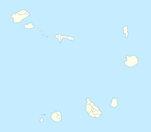
| Location | Western Santo Antão, Cape Verde |
| Coordinates | 17°03′11″N 25°21′40″W / 17.0531°N 25.36099°WCoordinates: 17°03′11″N 25°21′40″W / 17.0531°N 25.36099°W |
| Offshore water bodies | Atlantic Ocean |
|
Cape Verde
|
|
| Location | Ponta de Mangramde Santo Antão Cape Verde |
|---|---|
| Coordinates | 17°03′14.4″N 25°21′25.8″W / 17.054000°N 25.357167°W |
| Year first constructed | n/a |
| Foundation | concrete base |
| Construction | concrete tower |
| Tower shape | cylindrical tower with lantern |
| Markings / pattern | white tower, red lantern |
| Height | 3 metres (9.8 ft) |
| Focal height | 112 metres (367 ft) |
| Light source | solar power |
| Range | 13 nautical miles (24 km; 15 mi) |
| Characteristic | Fl (2) W 10s. |
| Admiralty number | D2954 |
| NGA number | 24092 |
| Cape Verde number | PT-2013 |
Ponta de Mangrande also Ponta Oeste (West Point) is the westernmost point of not only Cape Verde but all Africa (together with the mainland and its islands), it is located nearly 5 km northwest of Monte Trigo in the Island of Santo Antão and has no accessible roads. The headlands are one of the areas in Cape Verde that has no roads within the headland, also it sits on a separate mountain named Monte Cama Madeirense (997 m) connecting to the mountain range of Topo da Coroa. The headland's length is 5–6 km north to south and 1–2 km east to west.
Its etymology of Ponta Oeste, the other name is being in the westernmost of the island and the whole archipelago.
Some 25–30 km northwest is the Nola Seamount and over 230 km northwest is the Santo Antão Ridge. Also in the point's location, it is the closest land area from Cape Verde to one of the Caribbean Islands which is Barbados, being 3,681 km from the point near Stroude Land, About 2 km northeast at another point is the closest to the North American mainland being about 4,548 km from Little Dover at a point near Canso, Nova Scotia and all North America being about 4,146 km from the Avalon Peninsula.
As the seas are rough and dangerous in the area, having only a beach in the north of the headline. Four kilometers west there is a depth of 1,000 meters which forms a part of the Cape Verde Rise; about 12 km west has a depth of 2,000 meters and 30 km west is 3,000 meters. The depth of Nola Seamount, an underwater volcano is around only 140 meters deep and the west part is between 60-70 meters deep, but 40 km northwest of the headland has the water depth of over 3,000 meters. Nola Seamount may be the tallest submerged seamount within the Cape Verde Islands. During the Ice Age, the western part of the seamount was Nola Island and was flooded before the Late Ice Age.
Also, further northwest of the point could be the furthermost of the Canary Current.
The point in the northwest marked the line made by the Treaty of Tordesillas in 1494 that divided the spheres of Iberian influences 370 leagues (1,770 km) west of the point and extended up to the north and south poles, it marked the line between discovered and then undiscovered lands, the actual location would be at around at 17.5 N and in today's meridian around 42 degrees west of Greenwich, the line would be marked around twenty meridians west. In 1498, the northern part of the line in North America would not be included as John Cabot discovered a part of North America in 1498. The line existed for a couple of decades. The remaining line that divided Spanish and Portuguese possessions ceased to exist when Brazil became independent on September 1822, before other parts of Central and South America ended Spanish rule.
...
Wikipedia


