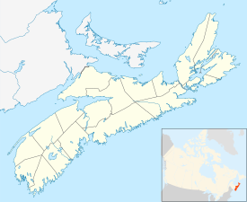
Canso, Nova Scotia
| Canso | |
|---|---|
| Community | |

Canso as seen from the harbour
|
|
| Nickname(s): Oldest Fishing Port on Mainland North America | |
| Motto: "Heritage, Heart & Home" | |
| Location of Canso, Nova Scotia | |
| Coordinates: 45°20′2″N 60°59′43″W / 45.33389°N 60.99528°W | |
| Country |
|
| Province |
|
| County | Guysbrough County |
| Founded | 1604 |
| Incorporated | May 14, 1901 |
| Government | |
| • Type | Town Council |
| • Mayor | Frank Fraser |
| • Governing Body | Canso Town Council |
| • MLA | Jim Boudreau (NDP) |
| • MP | Rodger Cuzner (L) |
| Area | |
| • Land | 5.42 km2 (2.09 sq mi) |
| Elevation | 0 - 14 m (−46 ft) |
| Population (2011) | |
| • Total | 806 |
| • Density | 148.8/km2 (385/sq mi) |
| Time zone | AST (UTC-4) |
| • Summer (DST) | ADT (UTC-3) |
| Canadian Postal code | B0H 1H0 |
| Area code(s) | 902 |
| Telephone Exchange | 366 |
| Median Earnings* | $30,502 |
| NTS Map | 011F07 |
| GNBC Code | CAGBW |
| Website | http://www.townofcanso.com |
For the headland, see Cape Canso.
Coordinates: 45°20′2″N 60°59′43″W / 45.33389°N 60.99528°W Canso is a community in Guysborough County, on the north-eastern tip of mainland Nova Scotia, Canada, next to Chedabucto Bay. In January 2012, it ceased to be a separate town and as of July 2012 was amalgamated into The Municipality of the District of Guysborough.
The area was established in 1604, along with Port Royal, Nova Scotia. The British construction of a fort in the village (1720), was instrumental in contributing to Dummer's War (1722–1725). The town is of national historic importance because it was one of only two British settlements in Nova Scotia prior to the establishment of Halifax (1749). Canso played a key role in the defeat of Louisbourg. Today, the town attracts people internationally for the annual Stan Rogers Folk Festival.
The community is located on the southern shore of Chedabucto Bay. The southern limit of the bay is at Cape Canso, a headland approximately 3 km (1.9 mi) southeast of the community.
...
Wikipedia

