Pokhara Airport
| Pokhara Airport | |||||||||||
|---|---|---|---|---|---|---|---|---|---|---|---|
 |
|||||||||||
| Summary | |||||||||||
| Airport type | Public | ||||||||||
| Operator | Civil Aviation Authority of Nepal (CAAN) | ||||||||||
| Serves | Pokhara, Nepal | ||||||||||
| Elevation AMSL | 2,712 ft / 827 m | ||||||||||
| Coordinates | Coordinates: 28°12′03″N 083°58′55″E / 28.20083°N 83.98194°E | ||||||||||
| Map | |||||||||||
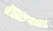
| Location of airport in Nepal | |||||||||||
| Runways | |||||||||||
|
|||||||||||
Pokhara Airport (IATA: PKR, ICAO: VNPK), is a regional airport serving Pokhara in Nepal. The airport was established on 4 July 1958 and is operated by the government (Civil Aviation Authority of Nepal). It offers regular connections to Kathmandu and Jomsom; and seasonal connections to Manang. Following a new agreement on air travel between India and Nepal, Pokhara is to be the site of Nepal's second international airport. Construction started in the southeast of Pokhara in 2009 but is only progressing slowly. In 2011 Buddha Air, a Nepali private airline, began international flights from Pokhara to Chaudhary Charan Singh International Airport in Lucknow, India, and has announced plans to fly to New Delhi's Indira Gandhi International Airport in the future.
The apron of the airport is tiny and can only handle 8 small propeller planes at a time. Pokhara Airport is a diversion airport for the main airport KTM in times of problems such as fog. Due to a short runway and crowded apron, flights must often be re-diverted to third airports with even shorter runways.
The airport is capable of handling aircraft from the Nepalese Army Air Service.
Pokhara daily flight scheduled
...
Wikipedia

