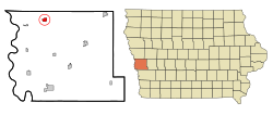
Pisgah, Iowa
| Pisgah, Iowa | |
|---|---|
| City | |
 |
|
| Coordinates: 41°49′58″N 95°55′35″W / 41.83278°N 95.92639°WCoordinates: 41°49′58″N 95°55′35″W / 41.83278°N 95.92639°W | |
| Country | United States |
| State | Iowa |
| County | Harrison |
| Area | |
| • Total | 1.01 sq mi (2.62 km2) |
| • Land | 1.01 sq mi (2.62 km2) |
| • Water | 0 sq mi (0 km2) |
| Elevation | 1,060 ft (323 m) |
| Population (2010) | |
| • Total | 251 |
| • Estimate (2016) | 237 |
| • Density | 248/sq mi (95.9/km2) |
| Time zone | Central (CST) (UTC-6) |
| • Summer (DST) | CDT (UTC-5) |
| ZIP code | 51564 |
| Area code(s) | 712 |
| FIPS code | 19-63075 |
| GNIS feature ID | 0460192 |
Pisgah is a city in Harrison County, Iowa, United States, along the Soldier River. The community is located in the midst of the Loess Hills. The population was 251 at the 2010 census.
Pisgah was laid out in 1899. The town's name is a biblical one chosen by members of The Church of Jesus Christ of Latter-day Saints (Mormons), who established a temporary settlement in central Iowa near a hill they christened Mount Pisgah. A post office called Pisgah has been in operation since 1902.
Pisgah is located at 41°49′58″N 95°55′35″W / 41.83278°N 95.92639°W (41.832684, -95.926464).
According to the United States Census Bureau, the city has a total area of 1.01 square miles (2.62 km2), all of it land.
Pisgah is also home of "The Old Home Cafe" made famous by CW McCall in the Old Home Bread commercials and in songs like "Old Home Filler-up Keep on Truckin Cafe".
As of the census of 2010, there were 251 people, 121 households, and 66 families residing in the city. The population density was 248.5 inhabitants per square mile (95.9/km2). There were 143 housing units at an average density of 141.6 per square mile (54.7/km2). The racial makeup of the city was 97.6% White, 0.8% Native American, and 1.6% from two or more races. Hispanic or Latino of any race were 3.2% of the population.
...
Wikipedia
