Pinellas County, Florida
| Pinellas County, Florida | ||
|---|---|---|
| County | ||
| County of Pinellas | ||
|
||
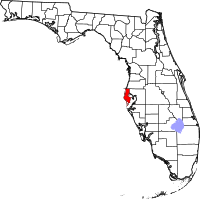
 Location in the U.S. state of Florida |
||
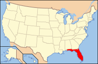
 Florida's location in the U.S. |
||
| Founded | January 1, 1912 | |
| Named for | Spanish Punta Piñal ("Point of Pines") | |
| Seat | Clearwater | |
| Largest city | St. Petersburg | |
| Area | ||
| • Total | 608 sq mi (1,575 km2) | |
| • Land | 274 sq mi (710 km2) | |
| • Water | 334 sq mi (865 km2), 55.0% | |
| Population (est.) | ||
| • (2015) | 949,827 | |
| • Density | 3,427/sq mi (1,323/km²) | |
| Congressional districts | 12th, 13th | |
| Time zone | Eastern: UTC-5/-4 | |
| Website | www |
|
Pinellas County is a county located in the state of Florida. As of the 2010 census, the population was 916,542. Its county seat is Clearwater, and its largest city is St. Petersburg.
Pinellas County is included in the Tampa–St. Petersburg–Clearwater, Florida Metropolitan Statistical Area.
Prior to European exploration and settlement the Pinellas peninsula, like all of Tampa Bay, was inhabited by the Indians, who built a town and large temple mound overlooking the bay in what is now Safety Harbor. The modern site is protected and can be visited as part of the County's Philippe Park.
During the early 16th century Spanish explorers discovered and slowly began exploring Florida, including Tampa Bay. In 1528 Panfilo de Narvaez landed in Pinellas, and 10 years later Hernando de Soto is thought to have explored the Tampa Bay Area. By the early 18th century the Tocobaga had been virtually annihilated, having fallen victim to European diseases from which they had no immunity, as well as European conflicts. Later Spanish explorers named the area Punta Piñal (Spanish for "Point of Pines" or "Piney Point"). After trading hands multiple times between the British and the Spanish, Spain finally ceded Florida to the United States in 1821, and in 1823 the U.S. Army established Fort Brooke (later Tampa).
...
Wikipedia

