Piloto Civil Norberto Fernández International Airport
|
Piloto Civil Norberto Fernández International Airport Aeropuerto de Rio Gallegos "Piloto Civil Norberto Fernández" |
|||||||||||
|---|---|---|---|---|---|---|---|---|---|---|---|
 |
|||||||||||
| Summary | |||||||||||
| Airport type | Public / Military | ||||||||||
| Operator | Government and Aeropuertos Argentina 2000 | ||||||||||
| Serves | Río Gallegos, Santa Cruz Province, Argentina | ||||||||||
| Location | Ruta N3, km 2618. (Z9400). RÍO GALLEGOS | ||||||||||
| Elevation AMSL | 66 ft / 20 m | ||||||||||
| Coordinates | 51°36′31″S 69°18′45″W / 51.60861°S 69.31250°WCoordinates: 51°36′31″S 69°18′45″W / 51.60861°S 69.31250°W | ||||||||||
| Map | |||||||||||
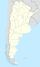
| Location of the airport in Argentina | |||||||||||
| Runways | |||||||||||
|
|||||||||||
| Statistics (2010) | |||||||||||
|
|||||||||||
| Passengers | 236,792 |
|---|---|
| Passenger change 09–10 |
|
| Aircraft movements | 3,395 |
| Movements change 09–10 |
|
Piloto Civil Norberto Fernández International Airport (Spanish: Aeropuerto de Rio Gallegos "Piloto Civil Norberto Fernández") (IATA: RGL, ICAO: SAWG) is located 4.5 km (2.8 mi) west-southwest of the center of Río Gallegos, a city in the Santa Cruz Province of Argentina. The airport covers an area of 1150 hectares (2841 acres) and is operated by Aeropuertos Argentina 2000 S.A.
It is served by Aerolíneas Argentinas, LAN Argentina and LADE. It has 149,750 m² of runways, 74,690 m² of taxiways, 2,285 m² of terminal, and 2,187 m² of hangars. It was constructed in 1964, and the paved runway was inaugurated in 1972 with a Caravelle flight of Aerolíneas Argentinas. Rio Gallegos' airport has the longest runway in the country.
...
Wikipedia

