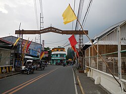
Pililla, Rizal
| Pililla | ||
|---|---|---|
| Municipality | ||
 |
||
|
||
 Map of Rizal showing the location of Pililla |
||
| Location within the Philippines | ||
| Coordinates: 14°29′N 121°18′E / 14.48°N 121.3°ECoordinates: 14°29′N 121°18′E / 14.48°N 121.3°E | ||
| Country | Philippines | |
| Region | CALABARZON (Region IV-A) | |
| Province | Rizal | |
| District | 2nd District of Rizal | |
| Founded | 1583 | |
| Barangays | 9 | |
| Government | ||
| • Mayor | Dan Masinsin | |
| Area | ||
| • Total | 69.95 km2 (27.01 sq mi) | |
| Population (2015 census) | ||
| • Total | 64,812 | |
| • Density | 930/km2 (2,400/sq mi) | |
| Time zone | PST (UTC+8) | |
| ZIP code | 1910 | |
| IDD : area code | +63 (0)2 | |
| Income class | 1st | |
Pililla is a first class urban municipality in the province of Rizal, Philippines. According to the 2015 census, it has a population of 64,812 people.
Pililla is just few kilometers away from Tanay, Rizal. It is surrounded by farms, small mountains, planes and trees. Pililla is known as the Green Field Municipality of Rizal.
Pililla has preserved some religious and non-religious tradition such as the Santa Cruzan or Flores de Mayo, wherein men and women walk all over town with their gowns. Town Fiesta during the month of July is being visited by people from the city to experience the celebrations especially the amateur shows at night. Like other towns, Pililla holds basketball league competitions for youth during summer. Pililla is also a destination for road cyclists because of its asphalted road, specifically in Sitio Bugarin in Barangay Halayhayin.
Pilang Munti (Pililla’s pre-Hispanic name) was ruled by a leader named Salyan Maginto. His territory encompasses the modern-day jurisdiction of the municipalities of Baras, Tanay, Pililla, and Jalajala. It was referenced as “munti” in contrast to the nearby and much larger town of Pila in the province of Laguna.
Cavada, a Spanish historian, revealed that in the year 1571, the Spanish forces conquered the towns along Laguna de Bay which they called “Rinconada de Moron” and Pilang Munti was among these which surrendered to the superior force of the Spaniards. Pilang Munti was incorporated to the colonial administration of Morong, and thus, the town was called "Pilang Morong".
In 1572, the first Spanish missionary priests arrived at Pilang Morong. Since then, Christianity was spread by the Spanish priests and in 1582, Fr. Juan de Placencia and Fr. Diego de Oropesa established a “visita” barrio at Pilang Morong. The place was divided by the Spaniards into 5 “rancherias”:
In 1583, Pilang Morong became an independent municipality. ”Pililla” was given as the official name of the newly formed town. The name “Pililla” arose from the diminutive rules in the Castillan language by modifying a name with “-illa” or “-illo” to indicate a smaller or younger version.
In 1599, 16 years after the town was given autonomy, the supreme government granted Pililla the authority to construct a church.
In 1600, the first church of cogon and bamboo was constructed in the Dolo Rio but this was burned and a church made of wood was constructed but this was also burned down with the whole town in 1632. Another church made of wood was built and this suffered the same fate in 1668. Two years later, the construction of the present church began. This was finished in 1673 and the edifice still stands up to the present.
...
Wikipedia


