Pilar, Buenos Aires
| Pilar | ||
|---|---|---|
| City | ||

Nuestra Señora del Pilar
|
||
|
||
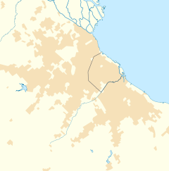
| Location in Greater Buenos Aires | ||
| Coordinates: 34°27′S 58°55′W / 34.450°S 58.917°WCoordinates: 34°27′S 58°55′W / 34.450°S 58.917°W | ||
| Country |
|
|
| Province |
|
|
| Partido | Pilar | |
| Government | ||
| • Intendant | Nicolas Ducoté (PRO) | |
| Elevation | 18 m (59 ft) | |
| Population (2010 census [INDEC]) | ||
| • Total | 296,826 | |
| CPA Base | B 1629 | |
| Area code(s) | +54 2322 | |
| Website | www.pilar.gov.ar | |
Pilar is a city in the province of Buenos Aires, Argentina with a population of 299,077 as per the 2010 census [INDEC]. It is part of the Greater Buenos Aires urban conurbation and is the seat of the administrative division of Pilar Partido. Since the early 1990s, Pilar has gained an increasingly upscale profile due to the development of numerous gated communities, country clubs and polo fields. [1]
The rural outpost that later became Pilar was first assigned a local authority in 1774 with the appointment of Ventura López Camelo as its first alcalde, or mayor. Pilar is the site where the Treaty of Pilar was signed on February 23, 1820, establishing the basis for Argentine federalism, as a result of which the city of Pilar is acknowledged as the "Cradle of National Federalism." This Treaty marked the end of the war between the League of Free Peoples formed by the provinces of Entre Ríos and Santa Fe against Buenos Aires.
The Parish of Our Lady of the Pillar was consecrated in 1856, and the partido (county) of Pilar was established in 1864, its first municipal mayor being Tomás Márquez.
A Buenos Aires and Pacific Railway line, its first, reached the town in 1886, and by 1895 nearly 10,000 inhabitants lived in Pilar. The opening of National Route 8 in 1934 eased the 58 kilometres (36 mi) commute to Buenos Aires, and Pilar subsequently became a growing commuter town.
...
Wikipedia


