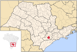
Piedade, São Paulo
| Piedade | |
|---|---|
| Municipality | |
 Location in São Paulo state |
|
| Location in Brazil | |
| Coordinates: 23°42′43″S 47°25′40″W / 23.71194°S 47.42778°WCoordinates: 23°42′43″S 47°25′40″W / 23.71194°S 47.42778°W | |
| Country |
|
| Region | Southeast Brazil |
| State | São Paulo |
| Metropolitan Region | Sorocaba |
| Area | |
| • Total | 746.87 km2 (288.37 sq mi) |
| Elevation | 781 m (2,562 ft) |
| Population (2015) | |
| • Total | 54,717 |
| • Density | 73/km2 (190/sq mi) |
| Time zone | BRT (UTC-3) |
| • Summer (DST) | BRST (UTC-2) |
Piedade is a municipality in the state of São Paulo in Brazil. It is part of the Metropolitan Region of Sorocaba. The population is 54,717 (2015 est.) in an area of 746.87 km². The elevation is 781 m.
The municipality contains part of the 26,250 hectares (64,900 acres) Jurupará State Park, created in 1992.
...
Wikipedia

